
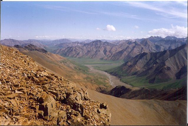
Volcan Misti | Peru, 1996
Distance: 38 km (23.6 mi) approx. Average Time: 2 to 3 days Start / Finish : There are three alternative routes to the summit. I started and finished my hike in the village of Chiguata, due to the fact it Read More …
Trail Guides, Gear Reviews, and Backpacking Tips
Distance: 38 km (23.6 mi) approx. Average Time: 2 to 3 days Start / Finish : There are three alternative routes to the summit. I started and finished my hike in the village of Chiguata, due to the fact it Read More …

Distance : 52km approx. Avg.Time : 3 – 4 days Start / Finish : Cusarare – Divisadero Both trailheads can be accessed by regular public transport from Creel. From Divisadero you have the option of either train or bus. Season Read More …

Distance : 70km approx. Avg.Time : 5-6 days Start / Finish : Recohuata Hot Springs – Pamachi Recohuata can be reached either on foot or 4WD vehicle from the town of Creel. From Pamachi, there is a dirt road which Read More …

NOTE: In December, 2013, Justin Lichter and I revisited the Sinforosa canyon as part of our Copper Canyon Traverse. Due to a marked increase in drug activity, I strongly recommend against all hiking in this area for the foreseeable future. Read More …

Distance : 52 km approx. Avg.Time : 3 days Start / Finish : Batopilas – Urique Both of these little towns are gems. Batopilas can be reached by regular bus service from Creel. This bus ride used to rate up Read More …
Distance: 44 miles (70.8 km) approx. Avg. Time: 4 – 5 days Start / Finish: I started my hike at Toklat River Ranger Station (mile 53 on the Park Road) and finished at the Eielson Visitor Centre (mile 66). The Read More …
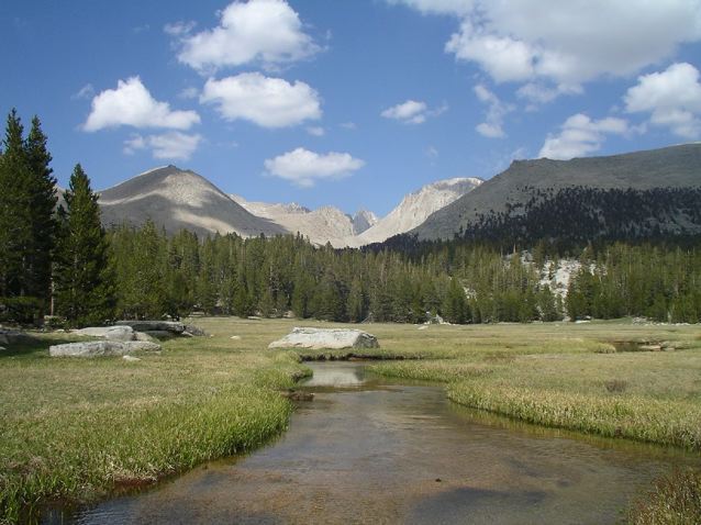
Distance: 211 miles (340km) Average Time: 10 – 14 days Difficulty: Moderate Start / Finish: Yosemite Valley – Mt. Whitney summit For transport details to the trailheads, see Backpack45.com. From the Whitney summit, you will need to walk a further Read More …

Distance : 2650miles (4265km) Avg.Time : 5 months Start / Finish : Campo – Manning Park Campo can be accessed by a regular bus service from San Diego. Alternatively you may be able to organise a ride with a “Trail Read More …

Originally an important trade route for the Tlingit indigenous people, the Chilkoot Trail became the primary gateway to the Yukon goldfields during the Klondike Gold Rush of 1896–99. Today, backpackers are able to retrace the footsteps of the “stampeders” on Read More …

Located in the remote Yukon Territory, Kluane National Park and Preserve is home to Canada’s highest mountain (Mount Logan – 5,959 m [ / 19, 5450 ft]), one of North America’s densest concentration of grizzly bears, and the largest non-polar Read More …

The Walker’s Haute Route from Chamonix to Zermatt takes the hiker on a visually stunning journey between Europe’s two most iconic mountains – Mont Blanc and the Matterhorn. Along the way, the trail passes by 10 of the 12 highest Read More …

One of Europe’s last true wilderness areas, Sarek National Park is situated north of the Arctic Circle in Swedish Lapland. It’s one of those places where everything seems to be big – valleys, glaciers, mountains, rivers and animals (e.g. bears, Read More …
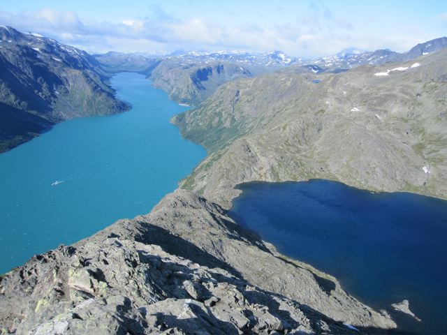
Distance: 58.4 miles (94 km) approx. Avg. Time: 4 days Start / Finish: Gjendesheim – Turtagro See VisitNorway.com for transport details to and from the trailheads. Season: Late June to early September. Difficulty: Moderate Maps / Info: The excellent 1:100,000 Jotunheimen Read More …
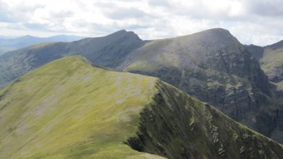
Distance: 51 km (32 mi) Avg. Time: 2 days Start / Finish: Killarney – Glencar As of 2010, there is no public transport to Glencar. Fortunately, hitching is relatively easy. Ask at the Climbers Inn if anyone is headed back Read More …
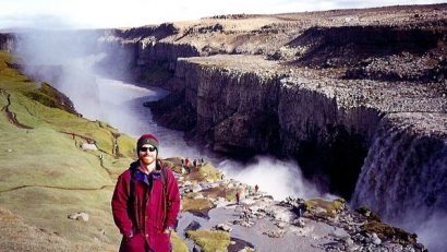
Distance: 21.1 miles (34 km) Avg. Time: 2 days Start / Finish: Dettifoss – Asbyrgi Click here for details on getting to and from Jokulsargljufur National Park. Difficulty: Easy Season: June to September Maps / Info: Jokulsargljufur means ‘glacial river Read More …

The Tour du Mont Blanc (TMB) is a spectacular multi-day trek around Western Europe’s highest peak (4807 m / 15,771 ft). Passing through France, Italy and Switzerland, it takes the hiker on an alpine tour de force of snow-capped peaks, Read More …
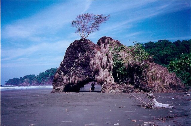
Distance: 39.1 miles (63 km) approx. Average Time: 3 days Difficulty: Start / Finish: San Pedrillo Ranger Station – La Palma Getting There & Away: Boat: My friends (Nels and Jules from Canada) and I hired a boat from Sierpe, which Read More …

Distance: 37.3 miles (60 km) Avg.Time : 3 days Start / Finish : Tingri – Everest Base Camp. Tingri is located on the Friendship Highway, which runs between Tibet and Nepal. There is frequent public transport in both directions. Similarly, Read More …

Distance: 49.7 miles (80 km) Avg.Time: 4 days Start / Finish: Ganden Monastery – Samye Monastery Public transport is available to both monasteries from Lhasa. Season: May – October Maps / Info: For all of my multi-day walks in Tibet, Read More …

Distance: 68.4 miles (110 km) approx. Avg.Time: 4 – 5 days Start / Finish: Chiu Monastery. Chiu is an ideal place to start and finish due to its spectacular hilltop setting, easy access and nearby hot springs. Season: May – Read More …