Traversing Iceland on foot is one of the Nordic region’s great adventures: a coast-to-coast hiking route that encompasses glaciers, volcanoes, deserts, canyons, crater lakes, hot springs, and black sand beaches. Yet for all its natural wonders, the Icelandic backcountry can be as unforgiving as it is beautiful. Preparation and adaptability are key, along with a stormworthy tent, an ironic sense of humor, and the knack for being comfortable with being uncomfortable.
I hiked the Iceland Traverse with Kate “Swept Away” Pickett in late August/September, 2023. This post covers the first two stages of our journey from Hraunhafnartangi Lighthouse to Lake Mývatn.
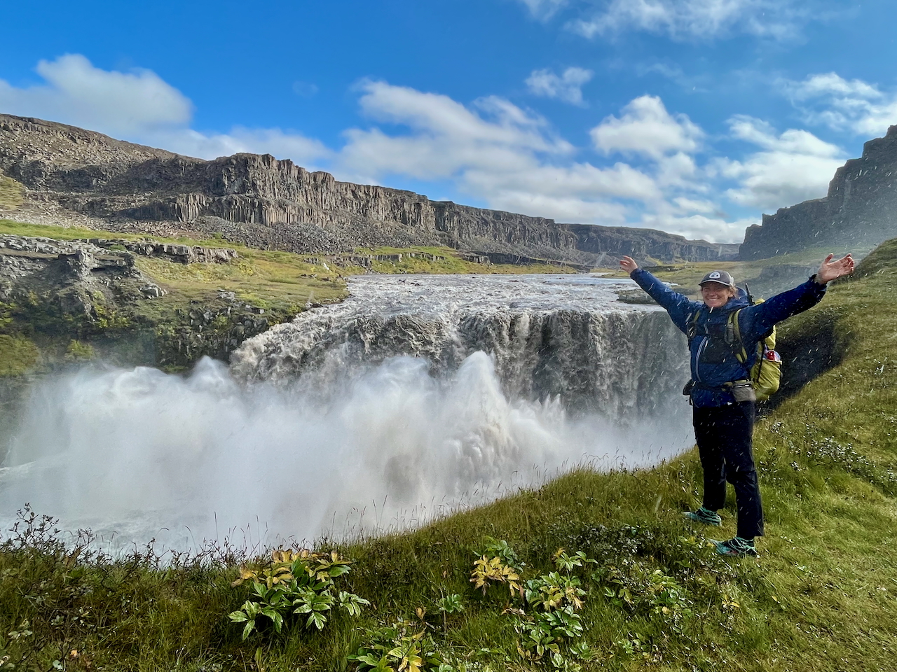
Soaking in – literally and figuratively – the thundering bass and misty curtains of Hafragilsfoss.
Note: Before starting the traverse, we spent an awesome week hiking around the Hornstrandir Peninsula in the country’s remote northwest corner. Click here for a detailed gear list from our two hikes in Iceland.
At a Glance
Distance: 600 km (373 mi) approx. (can vary between 520 km and 680 km depending on route choices)
Average Duration: 17-22 days
Difficulty Level: Moderate to challenging
Total Elevation Gain: 13,508 m (44,318 ft) approx.
Start/Finish:
- Hraunhafnartangi Lighthouse (North) – Dyrhólaey Lighthouse (South)
Stages: Five in total (Note: All distances are approximate and can vary considerably depending on side trips and route choices)
1. Hraunhafnaerrtangi Lighthouse to Asbyrgi (79 km/49 mi)
2. Asbyrgi to Reykjahlíð/Myvatn (73 km/45 mi)
3. Reykjahlíð/Mývatn to Dreki Hut (via Askja Caldera) (97 km/60 mi)
4. Dreki to Landmannalaugar (239 km/149 mi) (via Nŷidalur Hut)(Note: On this leg we had to deviate from our planned route due to a whopper of a three day storm).
5. Landmannalaugar to Dyrholaey Lighthouse (112 km/70 mi)
Route Options: This article focuses on an Iceland traverse between the northernmost and southernmost points. There are a bunch of variations available, not just from north to south, but also from east to west. For an overview of these route choices, along with a lot of other great planning information for traversing Iceland, see Łukasz Supergan’s excellent website.
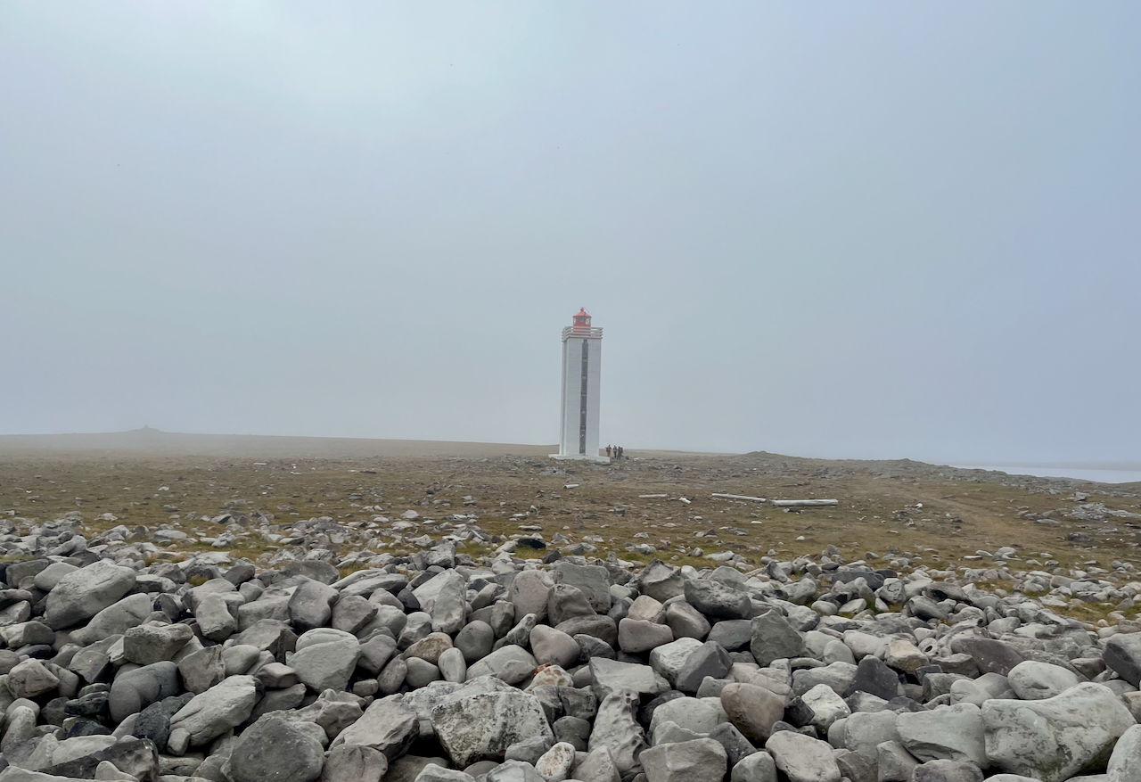
Hraunhafnartangi Lighthouse (Northern Terminus)
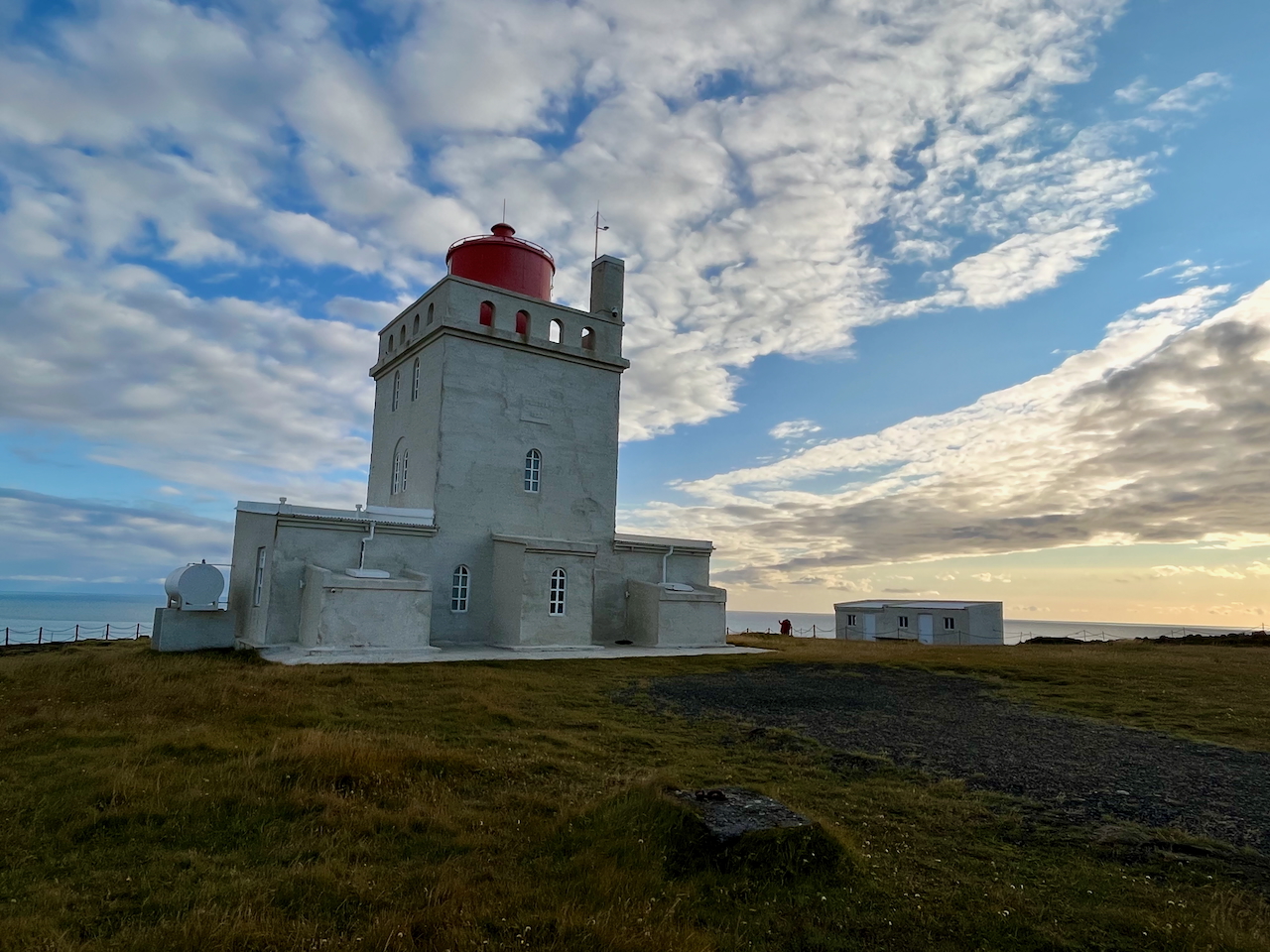
Dyrhólaey Lighthouse (Southern Terminus)
Highlights
- Ásbyrgi and Jökulsárgljúfur Canyons
- Lake Mývatn and its nearby hot springs
- Askja Caldera (including Öskjuvatn Lake the otherworldly Viti Crater)
- Ódáðahraun Desert (at approximately 6,000 sq km, the largest lava field on earth)
- Landmannalaugar hot springs
- Laugavegur and Fimmvörðuháls trails (including a side trip to Markarfljótsgljúfur Gorge)
- Dyrhólaey promontory
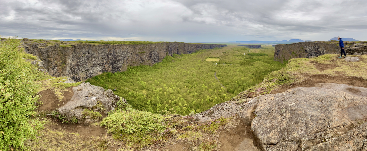
Ásbyrgi Canyon
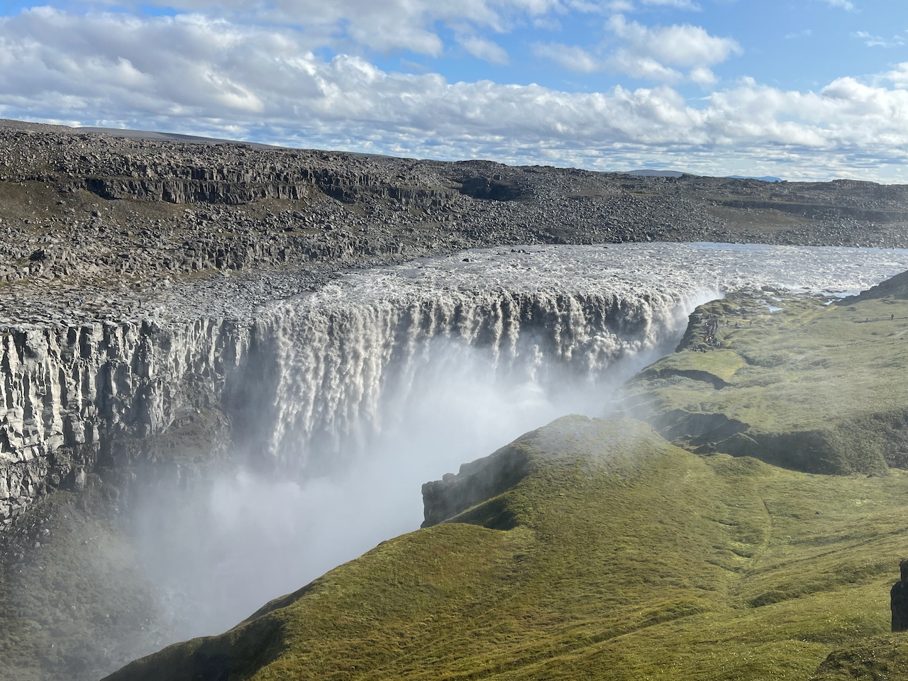
The mighty Dettifoss in Jökulsárgljúfur Canyon.
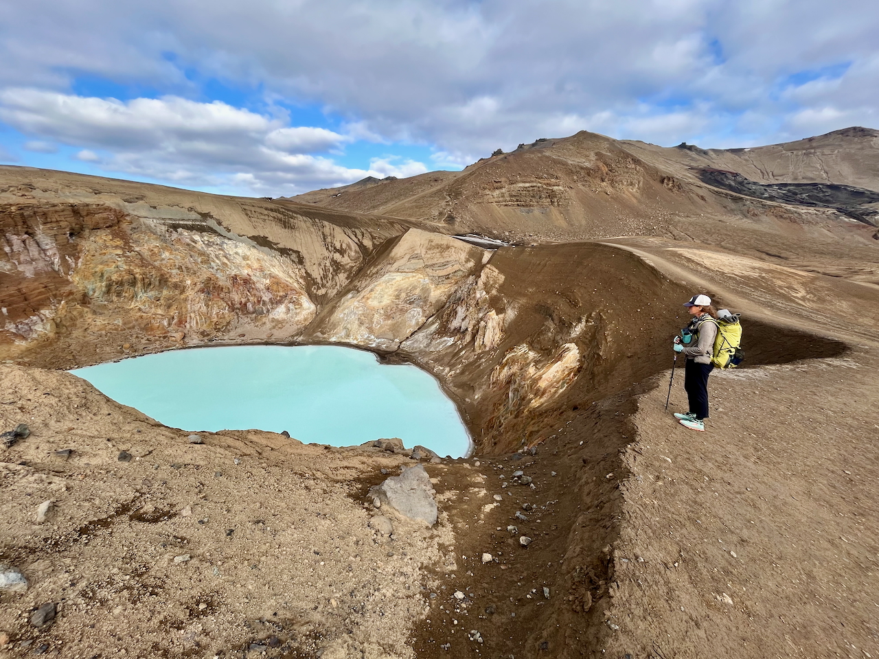
Overlooking Viti Crater in the Askja Caldera.
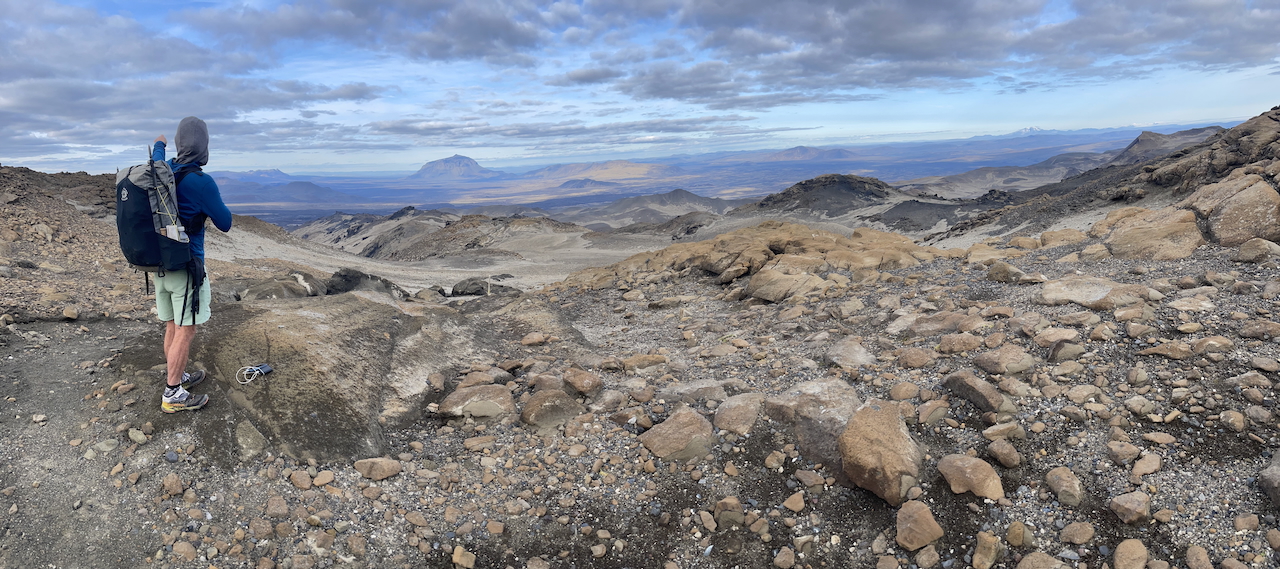
Leaving Askja Caldera and heading down toward Dreki Hut (photo by Kate Pickett).
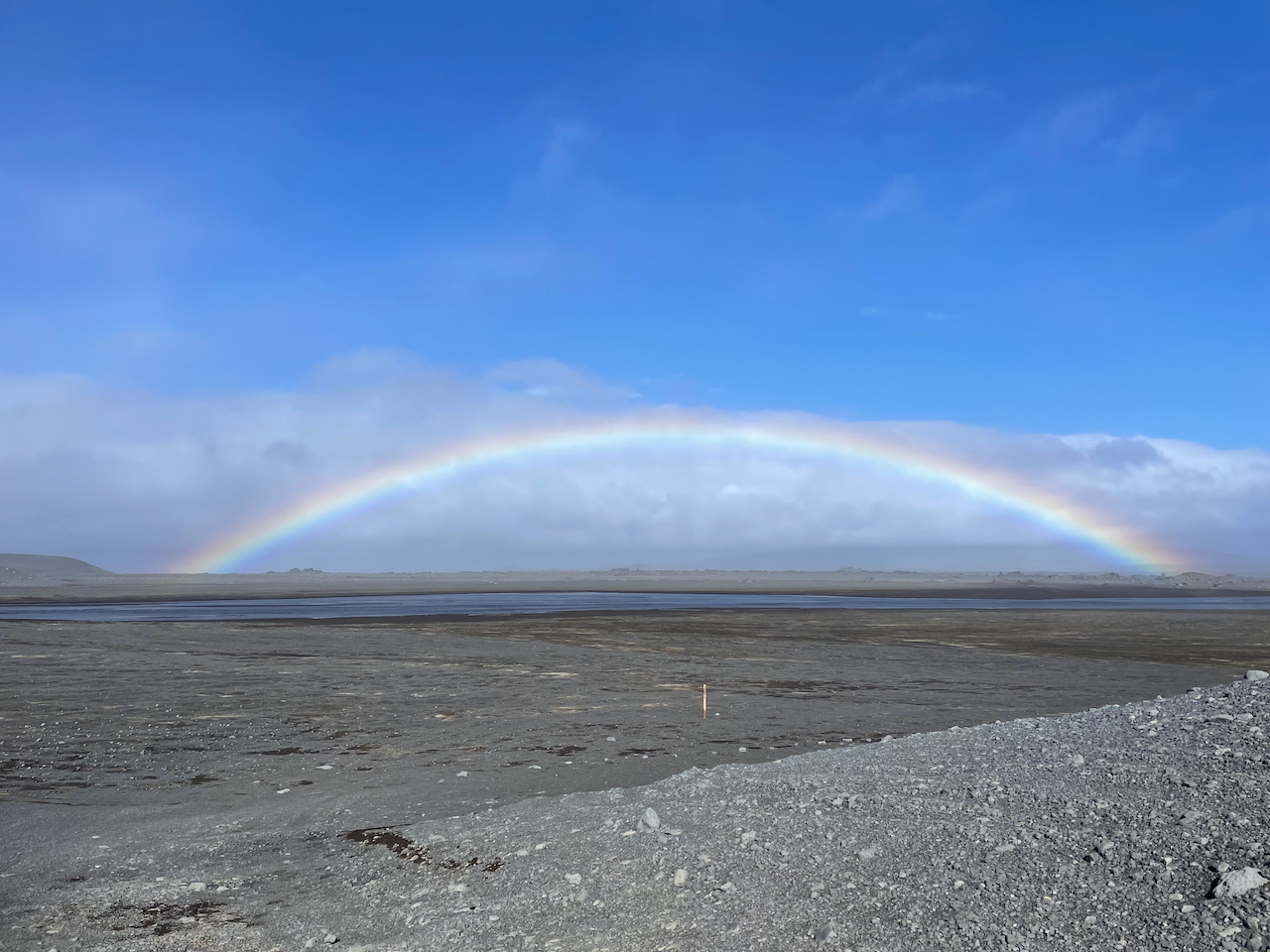
Rainbows, high winds, and shallow watercourses in the world’s largest volcanic desert.
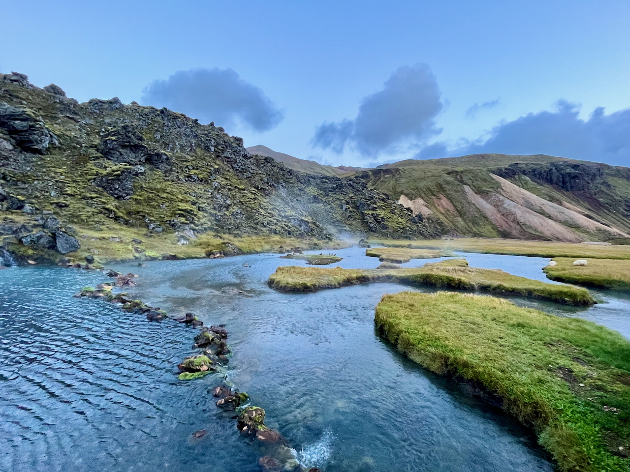
Landmannalaugar Hot Springs – I first soaked here in August, 2000, and it’s been one of my favourite hot springs ever since.
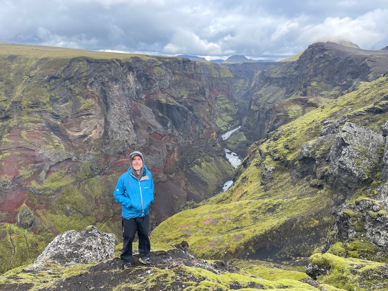
Side trip to the multi-hued gorge of Markarfljótsgljúfur (photo by Kate Pickett).
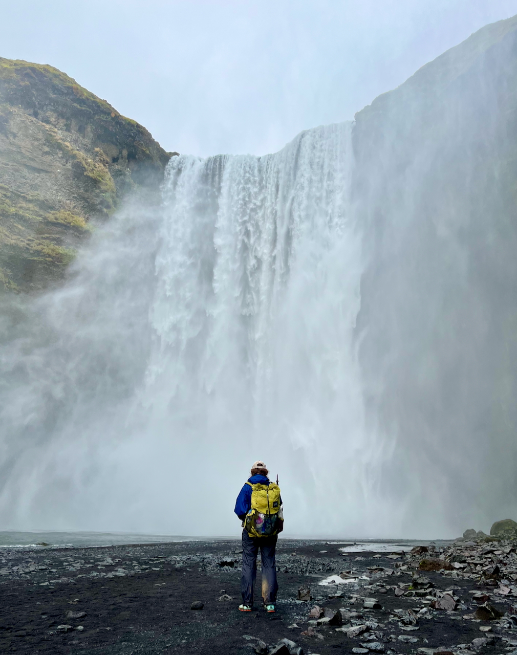
The incredible Skógafoss, at the southern terminus of the Fimmvörðuháls Trail. According to Viking legend, a treasure chest of gold lies hidden behind its roaring curtain of water… despite some urging and an offer to lend her my ultralight umbrella, Kate refused to investigate.
Planning Information
Getting There & Away:
As of 2026, the closest you can get to the northern terminus using public transport is the town of Húsavík*. From there, you can either try your luck hitching or organize a shuttle service to the lighthouse (Húsavík-based “Scandinavia Travel North” offer a shared service upon request / +354 894 1470). The southern terminus at Dyrhólaey Lighthouse lies 19 km (11.8 mi) from the full-service town of Vik (and 6 km/3.7 mi from Route 1). You can either hitch, call a taxi, or walk.
*Note: In years past there used to be a bus service running to the village of Raufarhöfn, which is located just 10 km (6.2 mi) SE of the Hraunhafnartangi lighthouse. From what I can gather, this service stopped running some time in the 2010s.
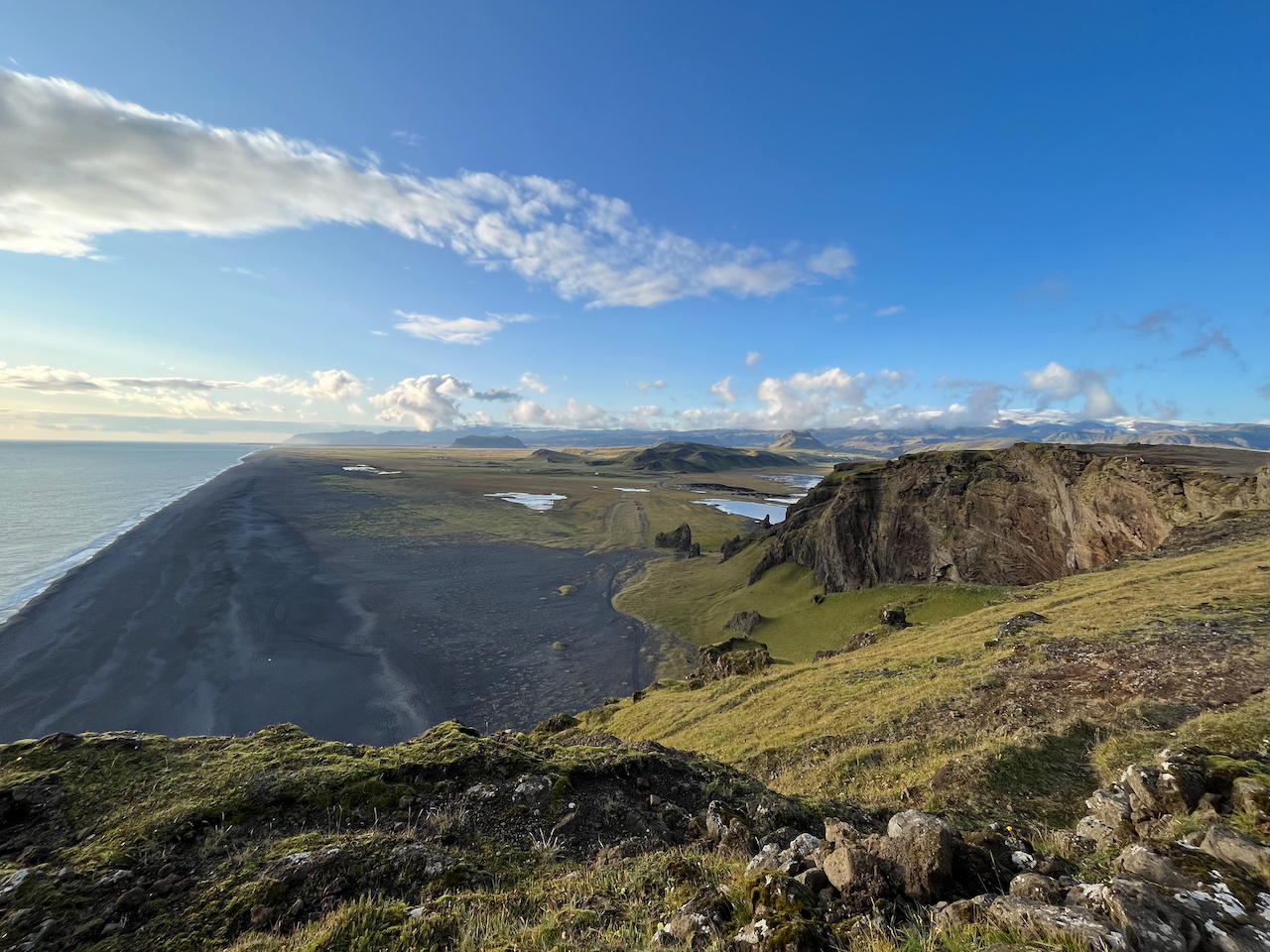
View from the Dyrhólaey promontory, southern terminus of the traverse.
- What did we do for Transport ?:
A. Reykjavik to Husavik – We flew from Reykjavik to Akureyri, then took a bus (Route 79) from there to Husavik (1.5 hours).
B. Northern Terminus – From Husavik, Kate and I shared a shuttle with three friends – Mike, Naomi, and Whitney – to the drop-off point near the Hraunhafnartangi Lighthouse (about 1.7 km walk). The cost was US$375 (for the five of us) in 2023, and the journey took about two hours. If I was by myself? I’d try hitching – just be prepared for a lengthy wait at Kópasker, located a short distance north of the Route 85 / 870 junction.
C. Southern Terminus – This is much easier, as there’s almost always a load of people at the Dyrhólaey Lighthouse. We walked to the end of the largish car park and instantly got a ride to Vik.
- Permits & Fees: No permits are required.
- Navigation: We used the Gaia GPS app (details to come in the Stages 3-5 post) and carried the 1:300,000 Central Highlands overview map which covered most of our route.
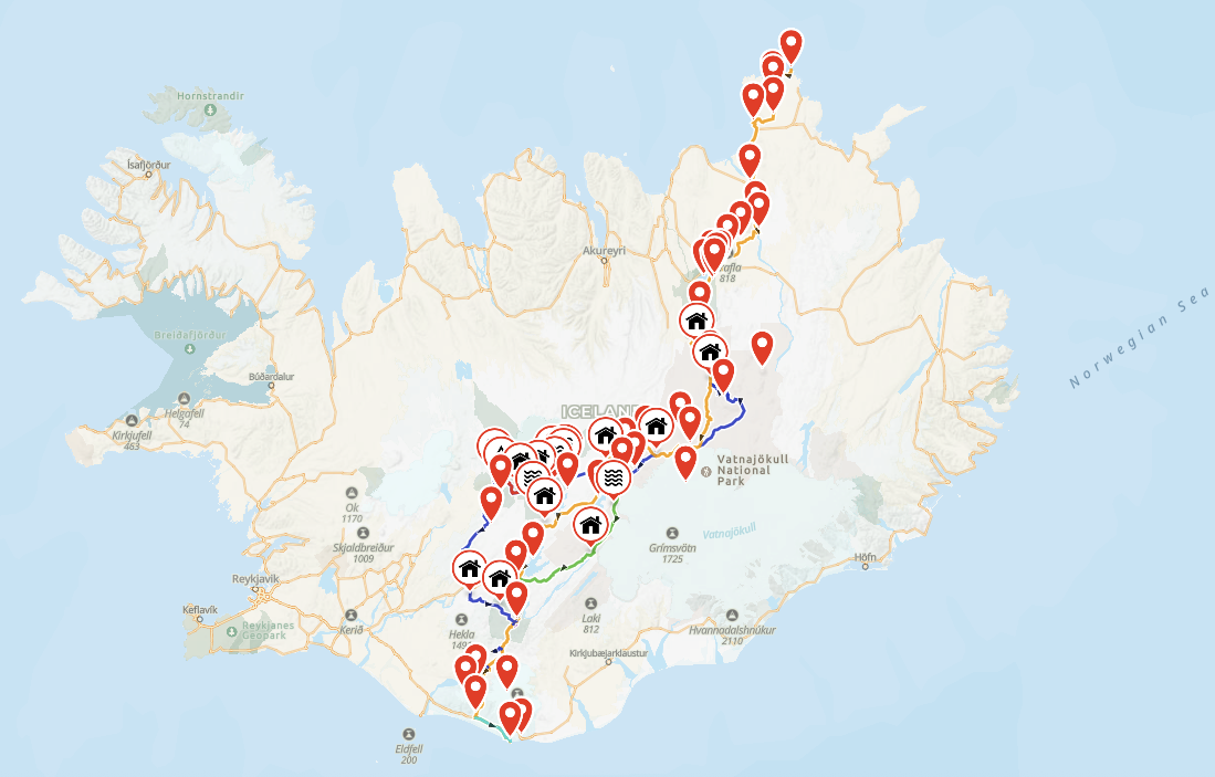
Overview map of the Iceland Traverse (N/S).
Water:
- For the most part, water in Iceland is safe to drink straight from the source. Exceptions include locations near human settlements or areas where livestock graze. In some central sections of the traverse, you may have to drink silty glacial water. In such cases (and it happened only once or twice), a filter will be your best option, though disposable coffee filter papers or a bandana can work in a pinch.
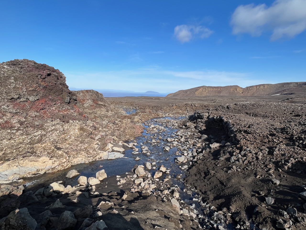
One of my favourite water sources on the trip, located between Dyngjufell Mountain Hut and Askja Caldera.
Resupply:
From a logistical perspective, working out your resupply strategy can be one of the toughest parts of the Iceland Traverse. Here are some tips and observations:
- Food Drops: In previous years, it was possible to pay Highland bus companies (Trex and Reykjavík Excursions) to deliver food drops to backcountry huts. However, by the time we hiked in 2023, these companies no longer offered this reasonably priced service. Alternative options include arranging a food drop at Dreki and/or Nýidalur Hut through a private tour company, or renting a 4×4 vehicle and delivering the supplies yourself. Neither option is cheap. I’m not sure whether the situation has changed since then, so if anyone has updated information, please drop me a line.
-
- What did we do?: We were fortunate to arrange a food drop with some friendly folks from Ferðafélag Íslands (a non-profit organization that runs approximately 40 mountain huts across Iceland). Before anyone asks, to the best of my knowledge, this is not a regular service offered by Ferðafélag.
- Shops along the Route: From north to south, the main resupply options are as follows: Kopasker (small grocery store), Ásbyrgi (gas station supermarket), Mývatn/Reyjkalid (medium-sized grocery store/very expensive), and Lanmannalaugar (expensive snacks and basic staples/also pricey).
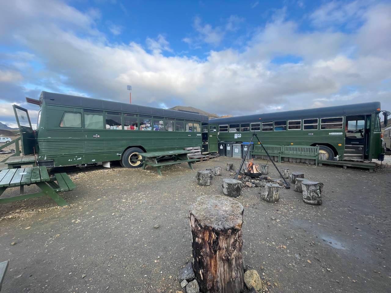
Mountain Mall shop in Landmannalaugar.
- Post Office: Just the one in Myvatn. It accepts packages (see below).
- Bringing Food from Overseas & purchasing supplies in Iceland: At the time of writing (October 2026), hikers can bring in up to 10 kg (22 lb) of food into Iceland. Kate and I each brought our quota, which consisted of typical backpacking fare such as health bars and dehydrated meals (Note: We used some of these provisions for our Hornstrandir hike). We supplemented these supplies with food purchased at the surprisingly good-value Bonus supermarket in Reykajavik. I can’t recommend this place enough. Wide range of options from chocolate, energy bars, and dried fruit, to cereals, powdered milk and quick-cook pasta and rice dishes.
- What did we do for Resupply?: Our stage-by-stage strategy was as follows:
-
- Stage 1 & 2: We started from Hraunhafnartangi Lighthouse with enough food to get us through to Mývatn (4.5 days). In Ásbyrgi, we stopped at the gas station shop for a coffee and some fruit.
- Stage 3: At the Mývatn post office, we picked up a resupply box that we’d sent ahead from Akureyri. We also bought some fresh food at the pricey local store. These supplies lasted us until Dreki Hut, roughly 2.5 days’ hiking from Mývatn via the Askja caldera.
- Stage 4: At Dreki, we picked up a couple of resupply boxes that the folks from Ferðafélag Íslands had left for us. From here, it was a 7-day hike to Landmannalaugar via Nyidalur Hut.
- Stage 5: At Landmannalaugar, we bought enough food at the Mountain Mall to last us until Skógar (2.5 days), where we spent the night at a nearby hostel that served breakfast. From there, it was just one more day to the finish at Dyrhólaey Lighthouse.
- Post-hike feast: I have to mention the Black Crust Pizzeria in Vik, where we enjoyed an awesome post-hike dinner. Whether you’re hiking the traverse or driving around the Ring Road, don’t miss eating here!
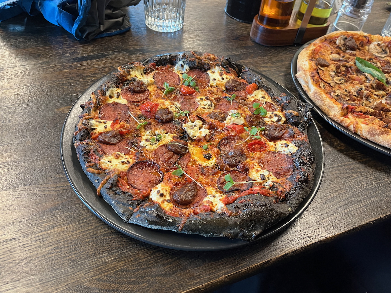
Black crust pizza (the dough is made with activated charcoal) – I feel hungry just looking at this photo.

The logo of the Bonus Supermarket chain is a pink piggy(bank). Wish I would have picked up one of their t-shirts!
Accommodation:
- Camping: Most hikers will spend the majority of nights camping. Mostly the wild variety, but also at established sites such as Lundur (66.07303, -16.43023), Ásbyrgi (66.02481, -16.49642), Vesturdal (65.93318, -16.55665), and Bjarg/Myvatn (65.64026, -16.91433).
- Backcountry huts: The ratio of camping to overnighting in huts will vary between hikers. In our case, we spent three nights indoors during our trip – all of which were during a huge multi-day storm while crossing the interior. Even if you’re planning to wild camp the entire route, it’s essential to know the location of all the huts along your chosen route, just in case Ma Nature really decides to turn it on.
- Choice of tent: This is one of the most important gear choices you’ll make for the Iceland Traverse. We had the Tarptent Stratospire 2, and it held up like a champ during some pretty heavy storms. I’m not saying you have to go full Hilleberg/4-Season. However, you’ll want a shelter that has a well-documented track record of holding up well when the wind really starts blowing. Over the years I’ve seen a handful of experienced thru-hikers who are used to the Triple Crown Type trails, bring shelters to Iceland which simply aren’t suitable for the conditions. Some get lucky and don’t have an issue. Others not so much. Speaking of which………..
- Campsite Selection: For much of the Iceland Traverse there is a dearth of natural windbreaks. This fact combined with the often-tempestuous weather, means that there is little room for error on the campsite selection front. To reduce the risk of your tent—along with your sleep and safety—being compromised, regularly consult your topo maps/gps app, and do everything possible to find suitable spots. Look for protection on the lee side of dunes, lava fields, shrubs, rocks, or any other natural feature that might offer some relief if the wind picks up (as it is wont to do).
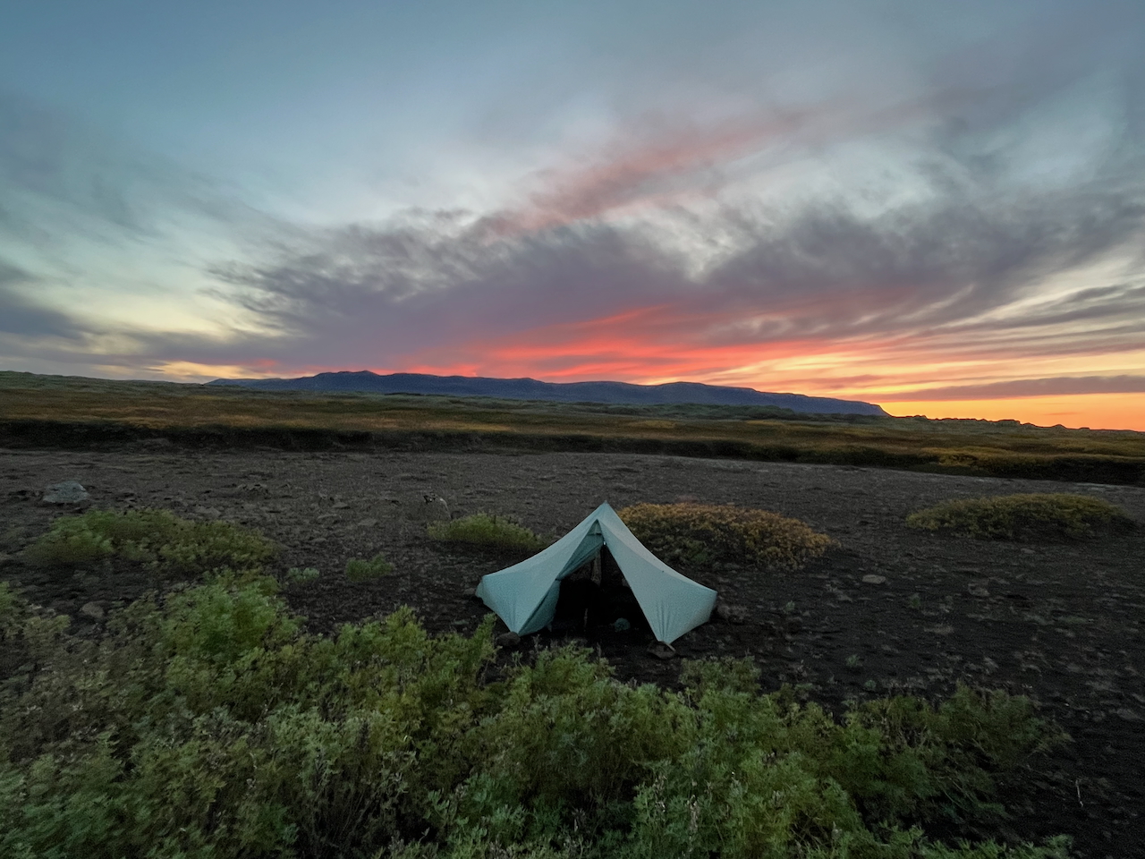
Camped among low-lying shrubs and mini-dunes on the stretch between Jökulsárgljúfur Canyon and Myvatn.
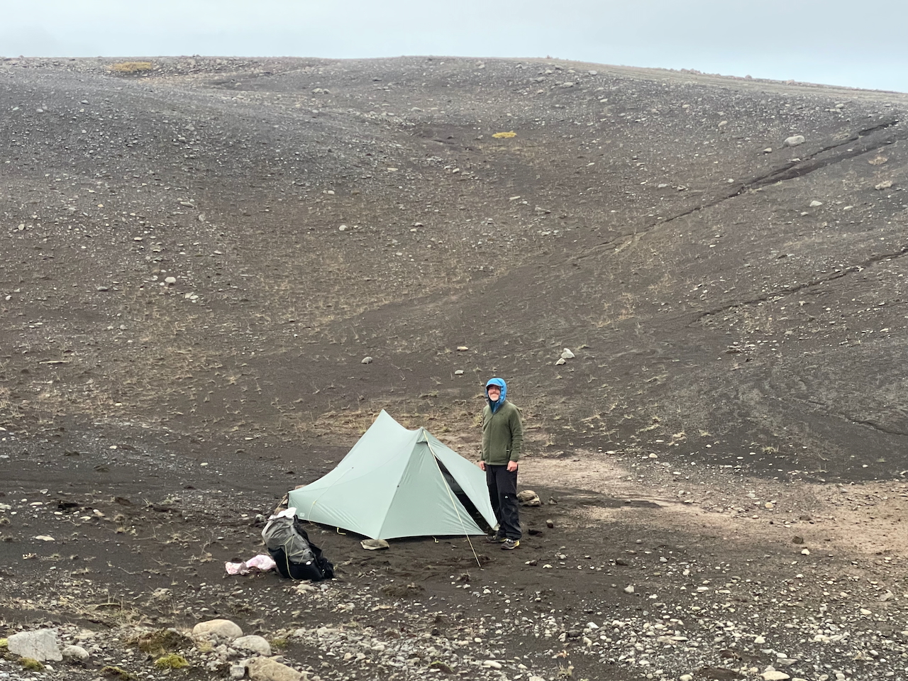
Camped among aeolian dunes between Nyadilur Hut and Landmannalaugar (Photo by Kate Pickett).
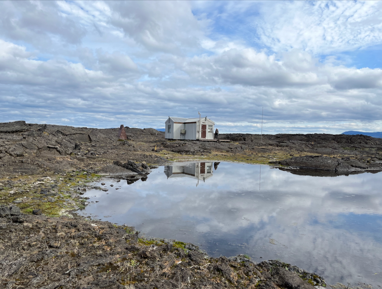
Botni Hut, located about 50 km (31 mi) south of Lake Myvatn.
Safety Tips
Due to the traverse’s combination of exposed terrain, unpredictable weather, and potentially hazardous river crossings, consider the following options:
- Personal Locator Beacon (e.g., Garmin inReach).
- SafeTravel Iceland App – For trip planning, safety alerts, and submitting your itinerary.
- 112 Iceland App – For contacting emergency services.
- Veður App – Official weather app from the Icelandic Meteorological Office.
In a nutshell, plan for the worst and hope for the best.
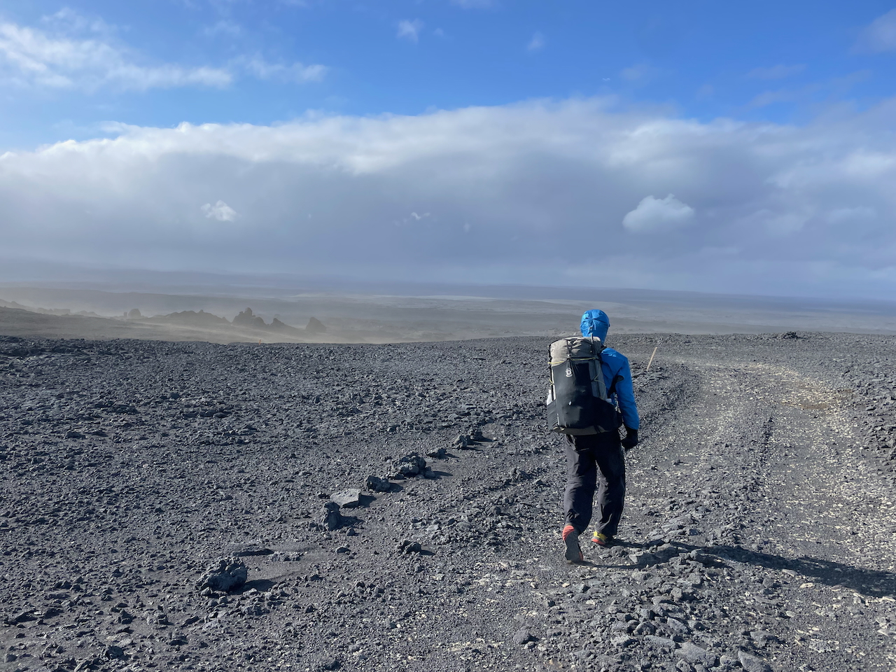
Hiking between Kitsufell and Gæsavatnaskali Huts (photo by Kate Pickett)
Pre-Hike Stay in Húsavík
If you’re beginning your hike in the far north, I highly recommend spending some time in Húsavík before setting out. Famed as the whale-watching capital of Iceland, we spent a fun couple of days visiting hot springs, museums, and exploring the village’s connection to both the Apollo Space Missions and Eurovision Song Contest: The Story of Fire Saga. The latter is a quirky movie starring Will Ferrell and Rachel McAdams that was largely set in Húsavík.
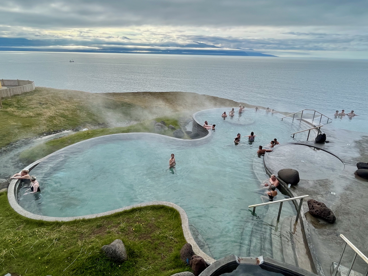
Geosea Geothermal Sea Baths
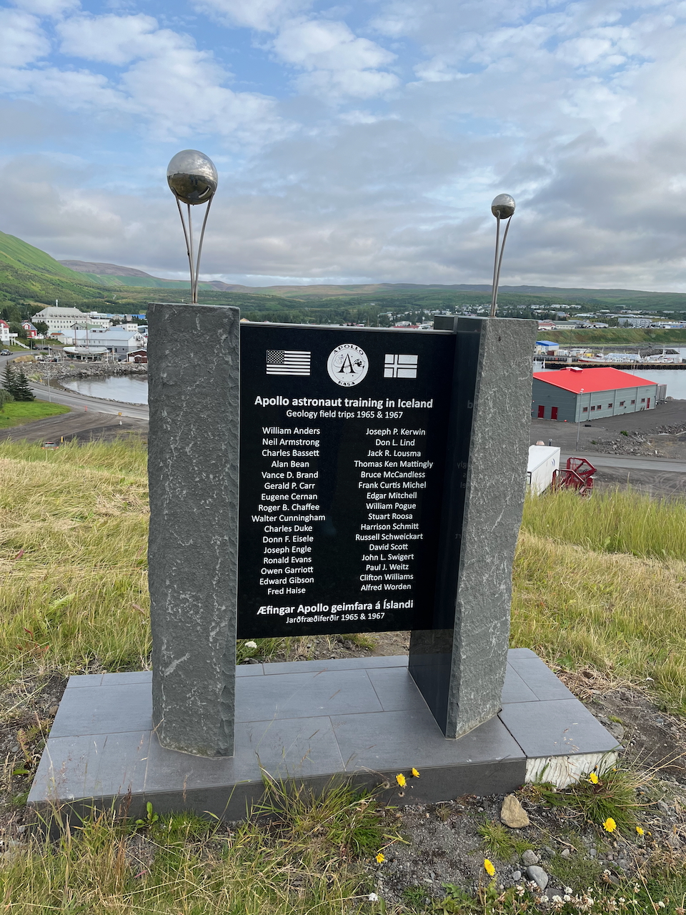
Monument to the Apollo astronauts who did geology field work near Dreki Hut and the Askja Caldera in 1965 and 1967.
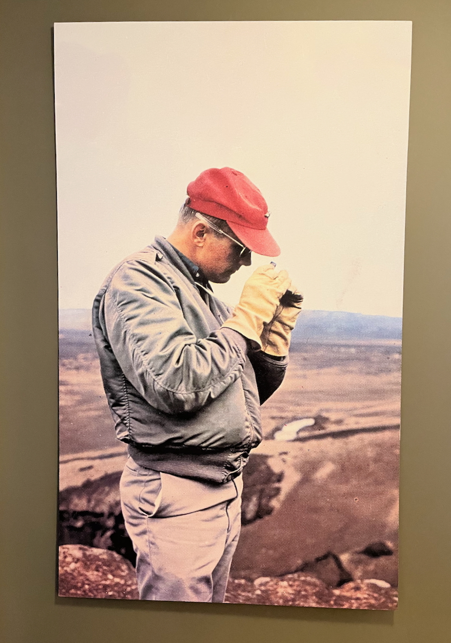
Neil Armstrong doing geological fieldwork near the Askja Caldera in 1967. Taken by Icelandic photojournalist Sverrir Pálsson, the photo is displayed at what was once the Exploration Museum in Húsavík, now integrated into the Eurovision Exhibition following the film’s success!
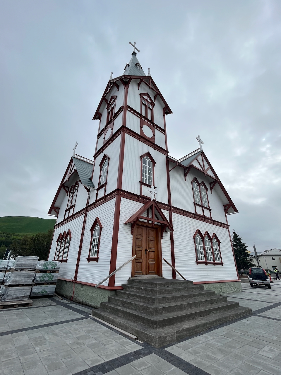
Built in 1907, the characterful Húsavíkurkirkja (Húsavík Church) is one of the village’s landmarks featured in Eurovision Song Contest: The Story of Fire Saga.
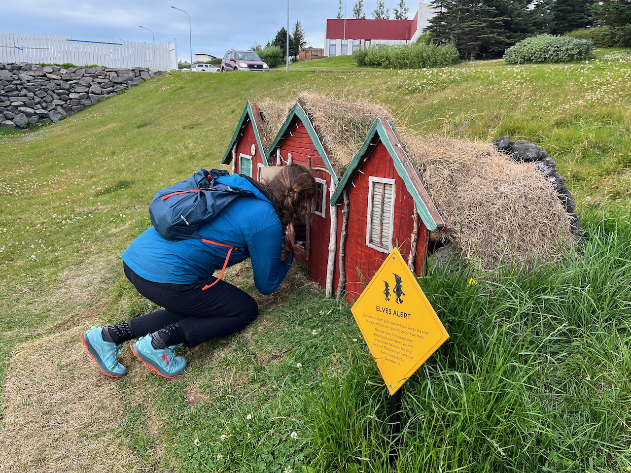
Chatting with locals.
Route Description & Icelandic Musings
Stages 1 – Hraunhafnartang Lighthouse to Asbyrgi – 79 km / 49 mi
The Hraunhafnartang Lighthouse is located at the northern tip of the Melrakkaslétta peninsula. A lonely beacon on a rocky, driftwood-strewn coastline, its location overlooking the Greenland Sea is an apt starting point for a journey that passes through some of Iceland’s remotest terrain. The initial stage to Asbyrgi measures roughly 79 km (49 mi) and consists of a buffet of surfaces, including dirt and paved roads, trails, unmarked 4WD tracks, and a short cross-country stretch. The easiest, and if truth be told least impressive of the routes quintet of sections, highlights included the coastal area around Hraunhafnartangi, and the mighty Jökulsá á Fjöllum River, which the route parallels for a good chunk of the trail’s breathtaking second stage.
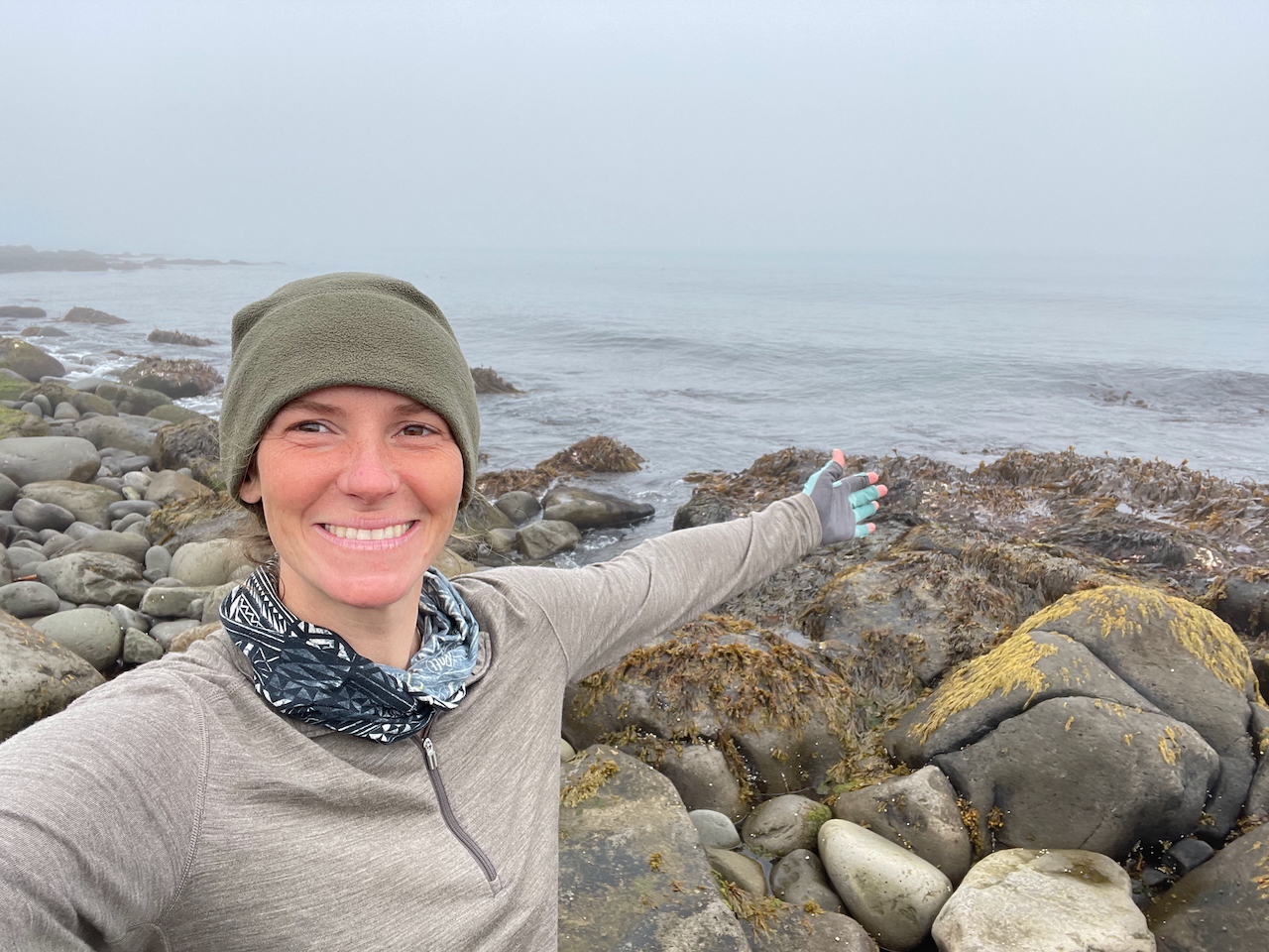
A dip of the toes in the Greenland Sea before beginning our journey.
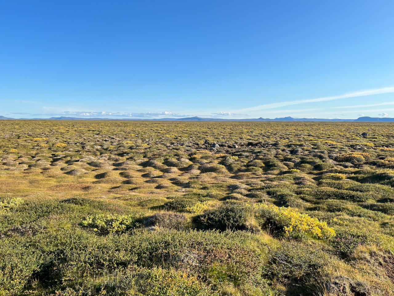
Heading due south across the Melrakkaslétta peninsula (which translates to “the plain of the polar fox”) on Day 1.
Why are there hardly any trees in Iceland?: When Iceland was first settled in the late ninth century, an estimated 20–30% of the country was covered in birch forests. Over the following centuries, settlers cleared much of this woodland for agriculture, livestock grazing, firewood, and construction. Combined with Iceland’s harsh climate and volcanic activity, widespread deforestation hindered the regeneration of trees and left the fragile soil exposed to erosion. By the beginning of the twentieth century, natural birch forest had dwindled to around 1% of the country’s land area. Today, government-supported reforestation projects are helping to reverse some of this loss, although forests still cover only a little over 2% of Iceland.
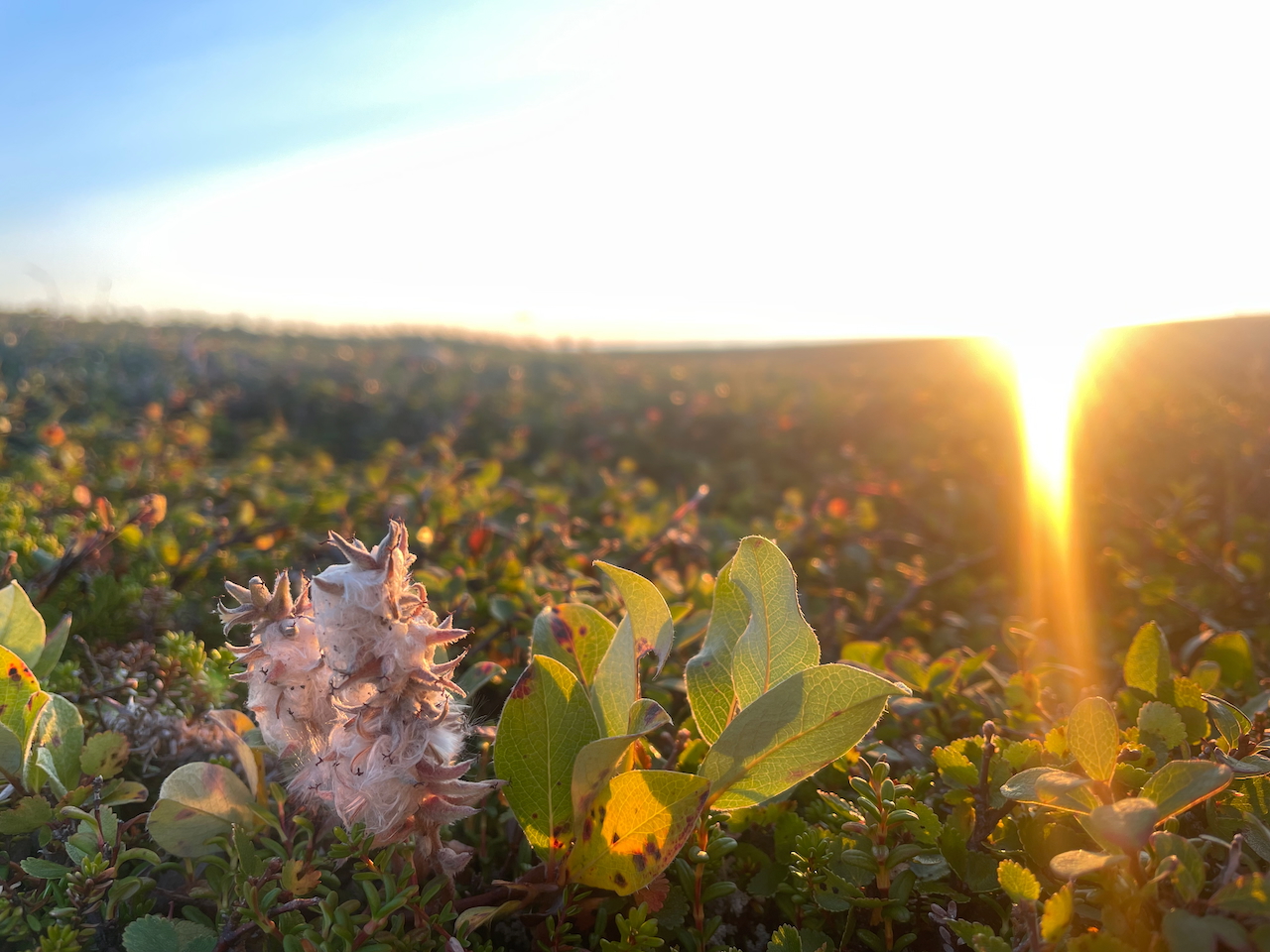
Arctic willow (Salix arctica) near sunset (photo by Kate Pickett).
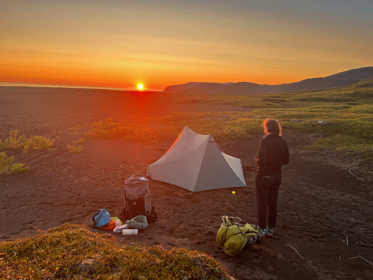
Sunset on Day 1 from our campsite, a few kilometres inland from Kópasker.
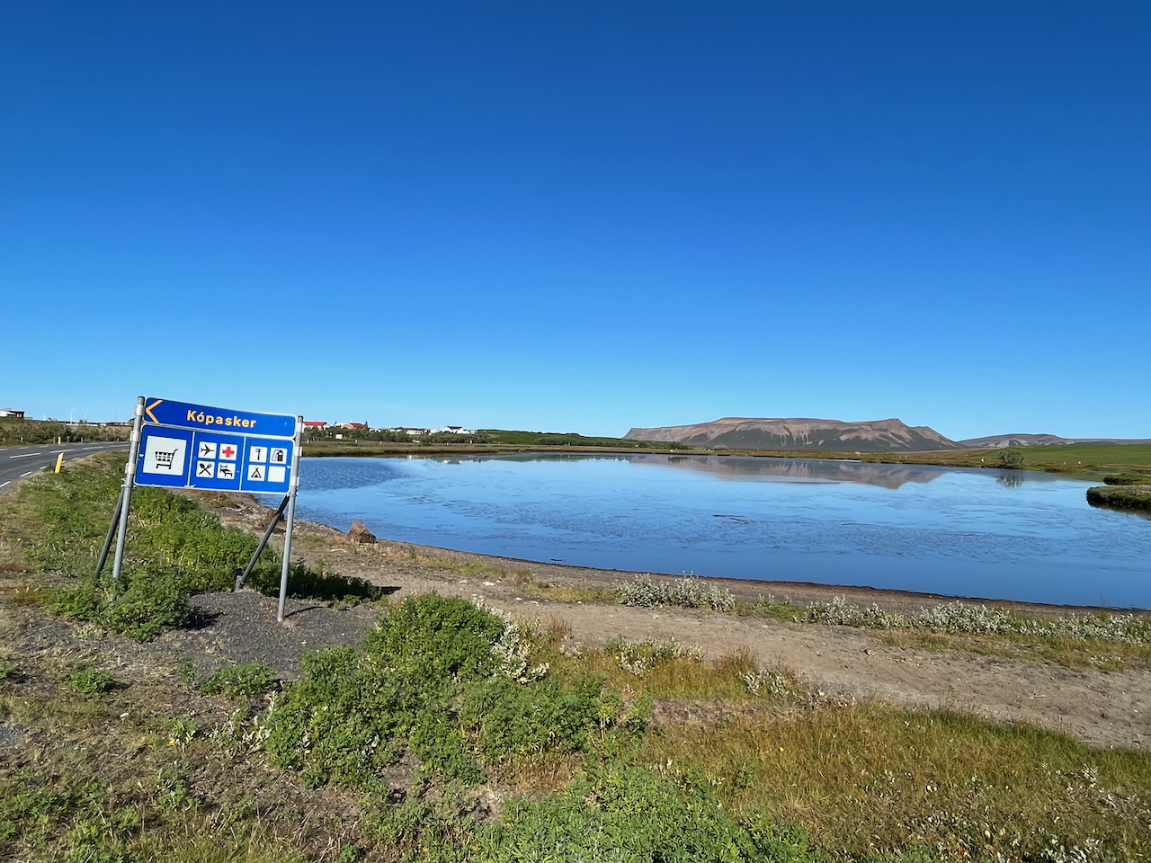
The village of Kópasker marked the beginning of the route’s longest stretch of road walking. Thankfully, dirt trails paralleled the pavement for part of the way.
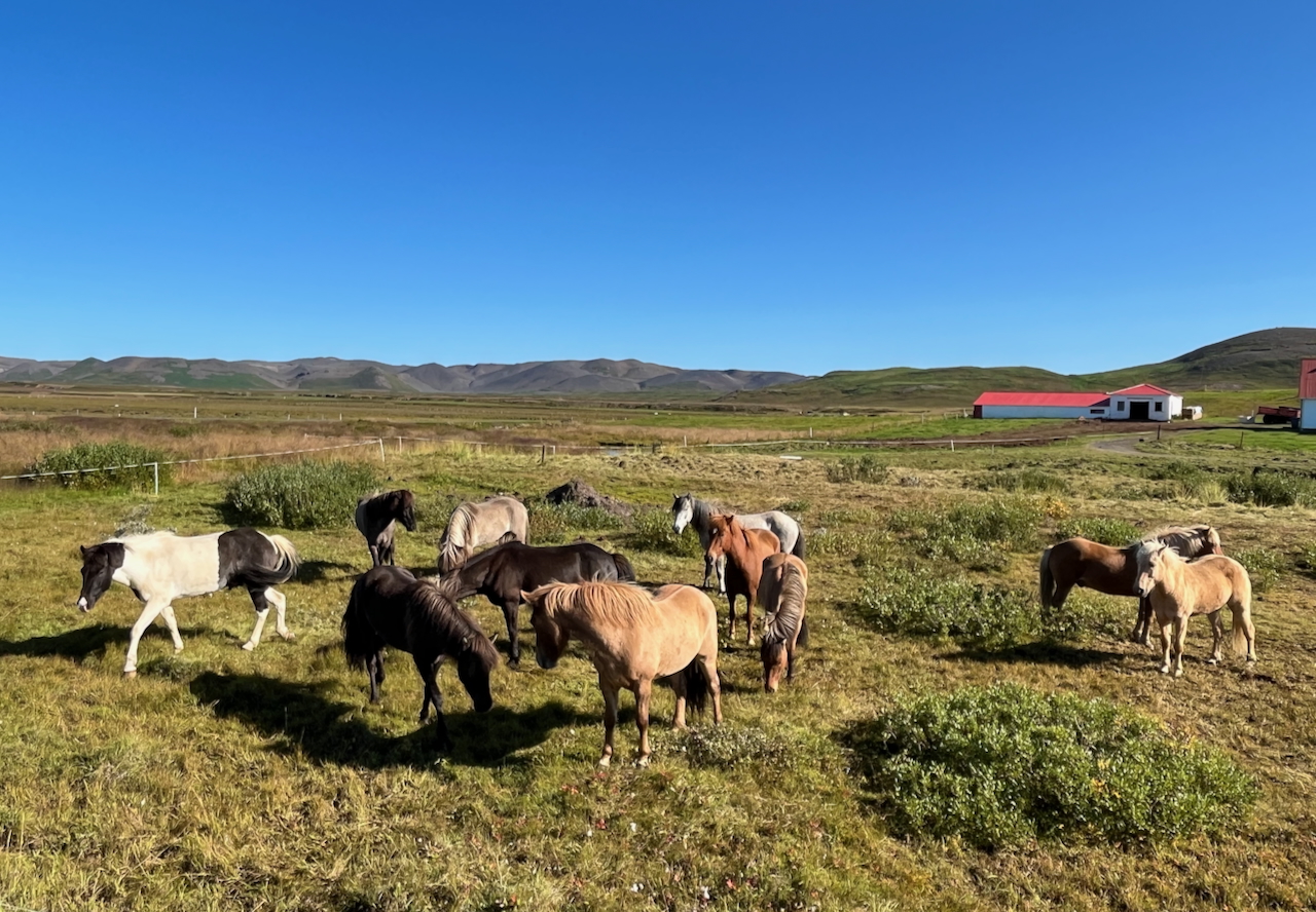
Unless you have the misfortune of running into a troll during a 2 am bathroom trip, the largest creature you’re likely to encounter on the traverse is the Icelandic horse.
The Five Gaits of Icelandic Horses: Originally brought to Iceland by Norse settlers in the ninth and tenth centuries, Icelandic horses are small in stature, agreeable by nature, and resilient to the harshest conditions. Their average life span is an uncommonly long 25 to 30 years (though they have been known to live over 40), and, apart from the standard walk, trot, and canter, they have an additional two gaits, the tölt and the skeið. The former is a fluid gait in which one foot always touches the ground. The latter is a high-speed, lateral gait used for short distances, in which both legs on one side simultaneously touch the ground.
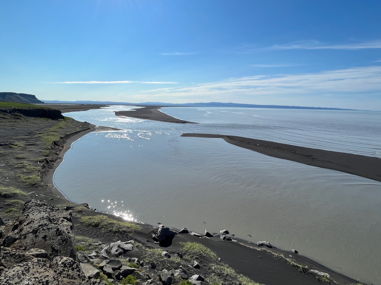
Iceland’s second-longest river, Jökulsá á Fjöllum, originates at the Vatnajökull ice cap. It flows for 206 km (128 mi) through the vast Ódáðahraun volcanic desert and the spectacular Jökulsárgljúfur Canyon before reaching the Greenland Sea.
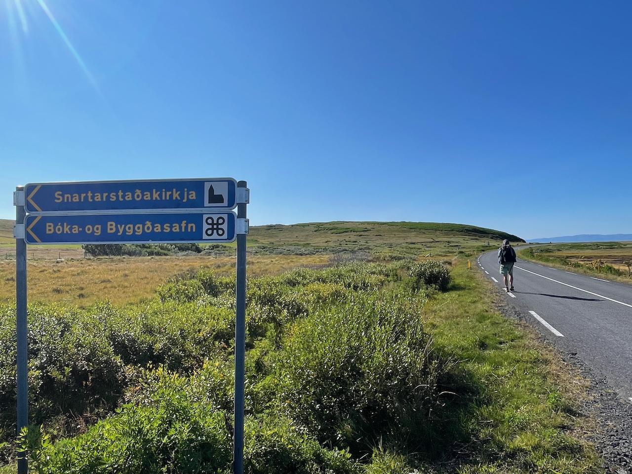
To paraphrase Samwise Gamgee: ‘…...a fair jaw-cracker Icelandic-language must be’ (photo by Kate Pickett).
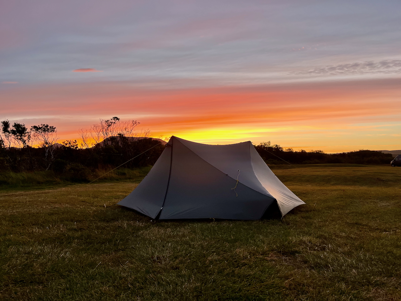
Day 2 Campsite at Lundur. Unfortunately, the adjacent hot springs was closed! (photo by Kate Pickett)
Stage 2 – Asbyrgi to Lake Mývatn
Stretching roughly 73 km (45 mi) from Asbyrgi Canyon to Reyjkalid on Lake Mývatn, the second part of the Iceland Traverse is usually done over two days. On Day 1, the route passes through the otherworldly Jökulsárgljúfur Canyon, which features the fantastical volcanic formations of Hljóðaklettar and the waterfalls of Dettifoss, Selfoss and Hafragilsfoss. After leaving Iceland’s “Grand Canyon,” the route heads southwest across a largely barren expanse. Following a combination of little-used 4WD tracks and cross-country, it winds its way past Jörundur and Krafla Volcanos (818 m/2,684 ft), the latter of which has erupted 29 times since Iceland was first settled. The final stretch of stage 2 is along Route 1 (aka “the Ring Road”) and includes a visit to the impressive geothermal area of Hverir and the not-to-be-missed Myvatn Nature Baths (now known as Earth Lagoon).
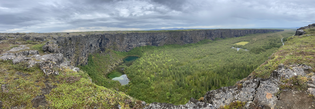
The horseshoe-shaped Ásbyrgi Canyon
The Twin Histories of Ásbyrgi Canyon: Geologically speaking, Ásbyrgi Canyon was formed after multiple catastrophic floods. These inundations occurred approximately 9,000 and 3,000 years ago when volcanic explosions underneath the Vatnajökull ice cap led to glacial bursts, which in turn carved out and sculpted the natural wonder we see today. A more colorful origin story of the horseshoe-shaped Ásbyrgi concerns the Norse god Odin and his eight-legged flying steed, Sleipnir. According to legend, Odin was riding around the world on his trusty companion when Sleipnir accidentally flew too close to the earth. As a result, one of his hooves touched the ground and left a deep, indelible print, which we now know as Ásbyrgi Canyon.
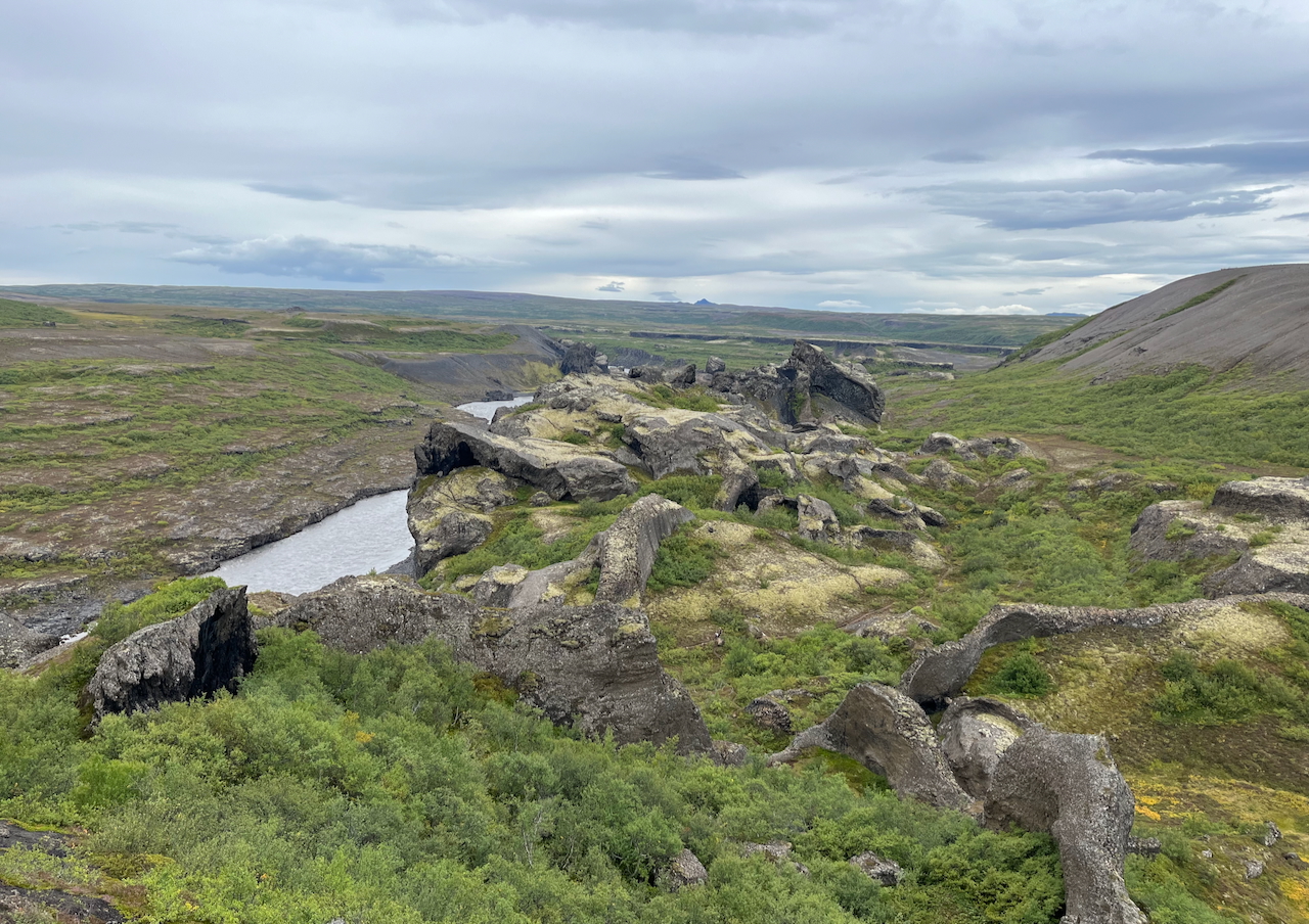
Entering the Hljóðaklettar (“echo rocks”), which are the eroded remains of ancient volcanic conduits.
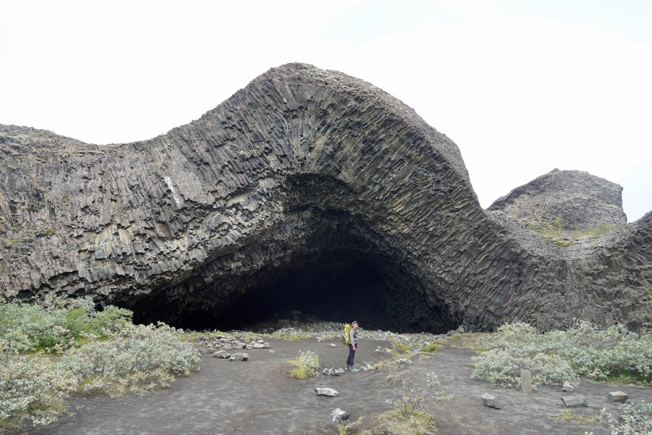
One of the highlights of the Hljóðaklettar section was Kirkjan (which translates to “the church”).
The Choices of Jökulsárgljúfur Canyon: There are different route options available to hikers through Jökulsárgljúfur Canyon. The most expedient is rarely (in fact never) the most interesting. Case in point: the remarkable basalt columns and caves of Hljóðaklettar, which are the eroded remains of ancient volcanic conduits. Further south, the same principle holds true for the side trip to Karl og Kerling (“the old man and old women”), and the riverside path which leads to the thundering Hafragilsfoss, a 27 m (89 ft) high and 91 m (299 ft) wide waterfall. When it comes to hiking through the Jökulsárgljúfur Canyon, as a general rule of thumb, always take the trail closest to the river.
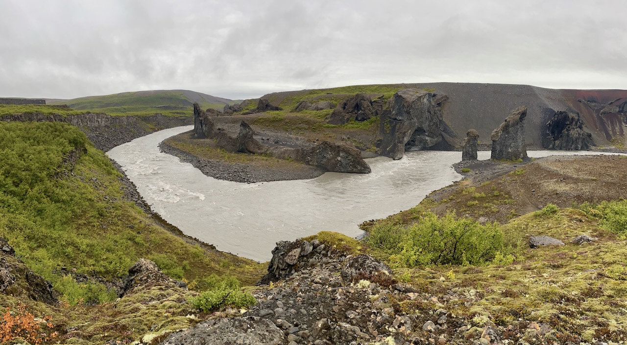
The twin rock towers of Karl og Kerling (“the old man and old woman”), which according to local legend are petrified trolls.
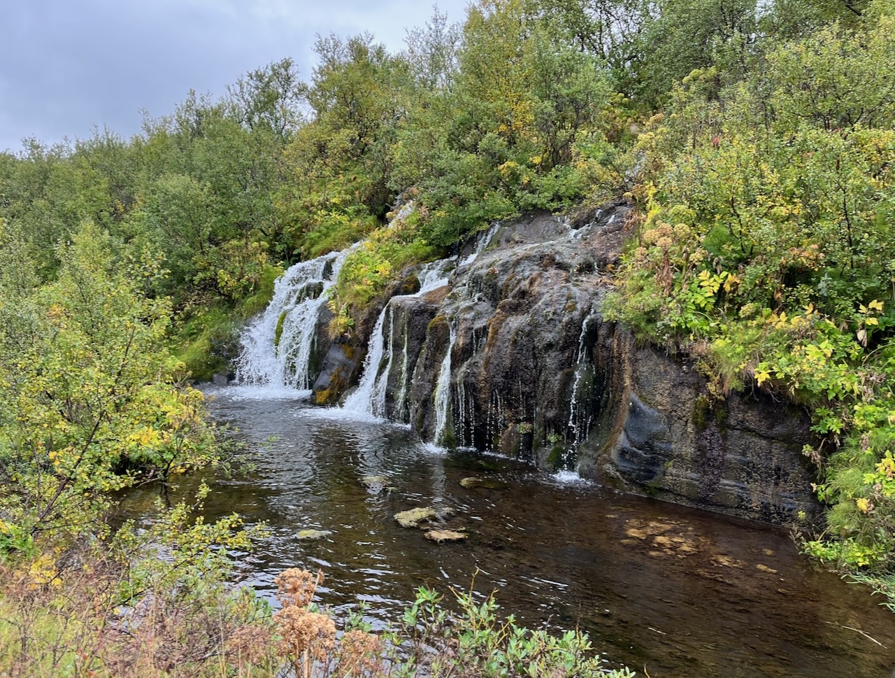
One of the prettiest sections of the canyon, the lush environs of Hólmatungur feature bubbling streams, waterfalls, and wooden footbridges.
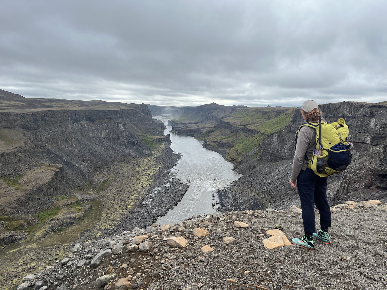
Jökulsárgljúfur Canyon stretches for 25 kilometres (15.5 mi) through the rugged volcanic landscape of northern Iceland.
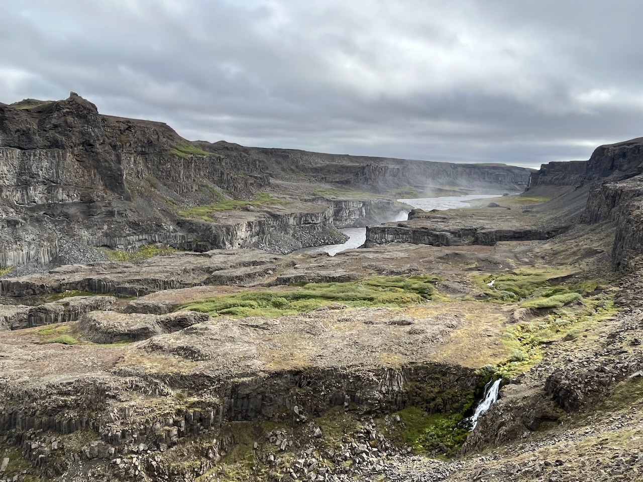
Dropping into the valley floor from the Jökulsárgljúfur – Hafragil junction.
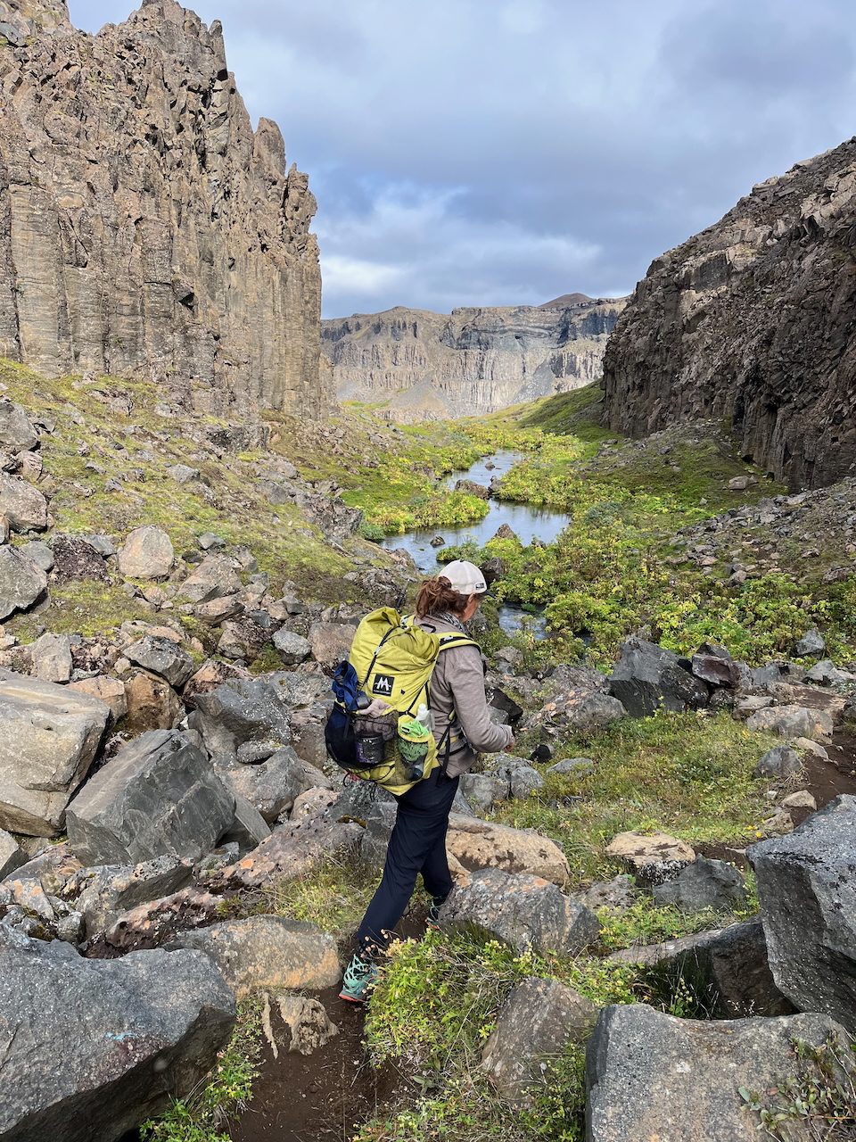
Column-like rock walls, meandering streams, and patches of blueberries and bilberries.
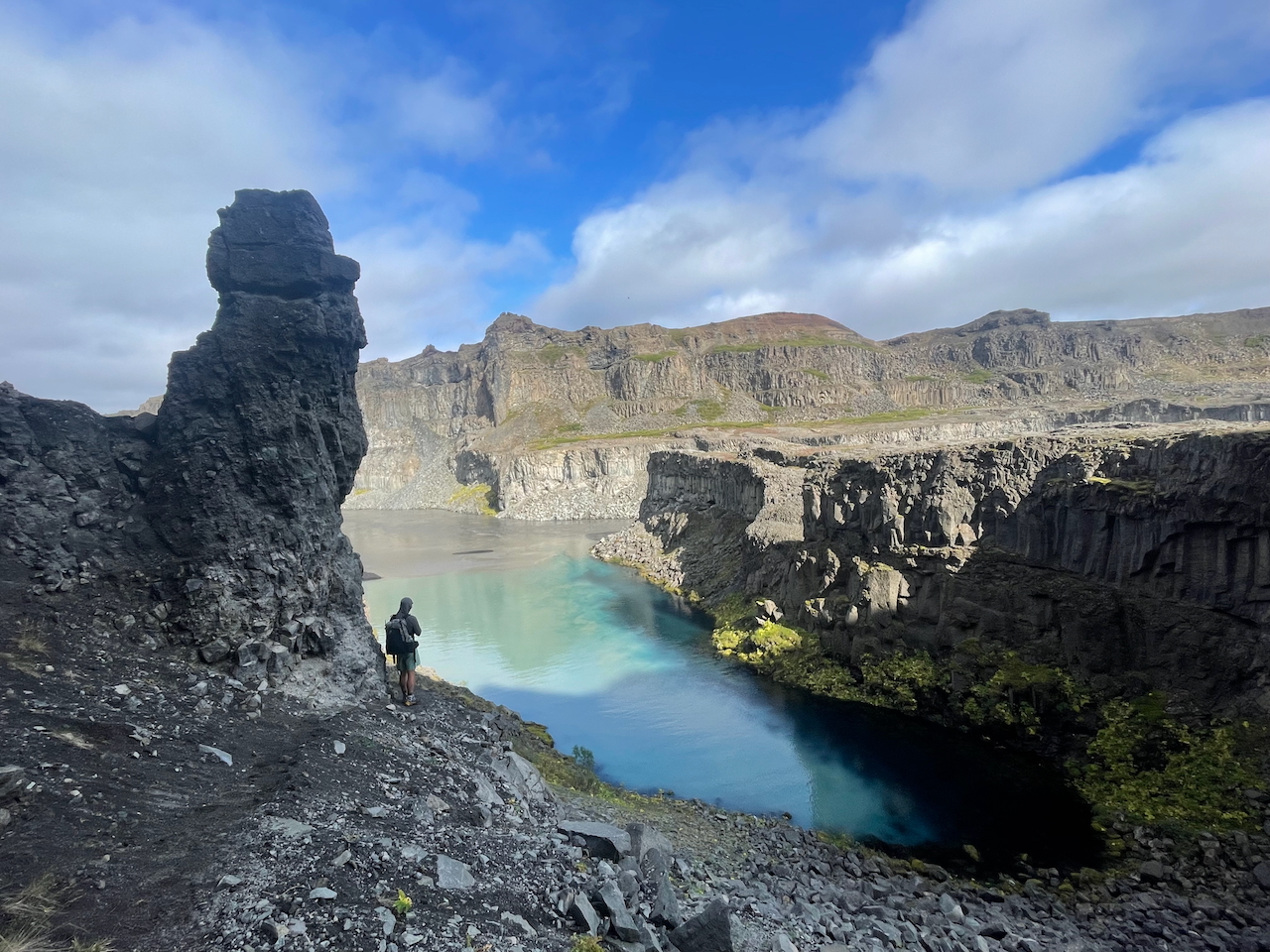
Where glacial grey meets turquoise blue (photo by Kate Pickett).
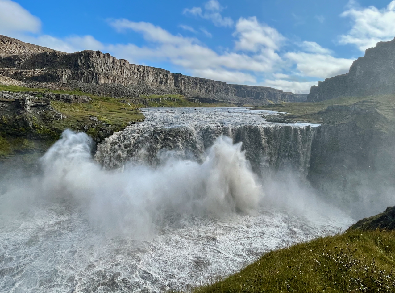
We were fortunate to have the thundering Hafragilsfoss (27 m high / 91 m wide) to ourselves.
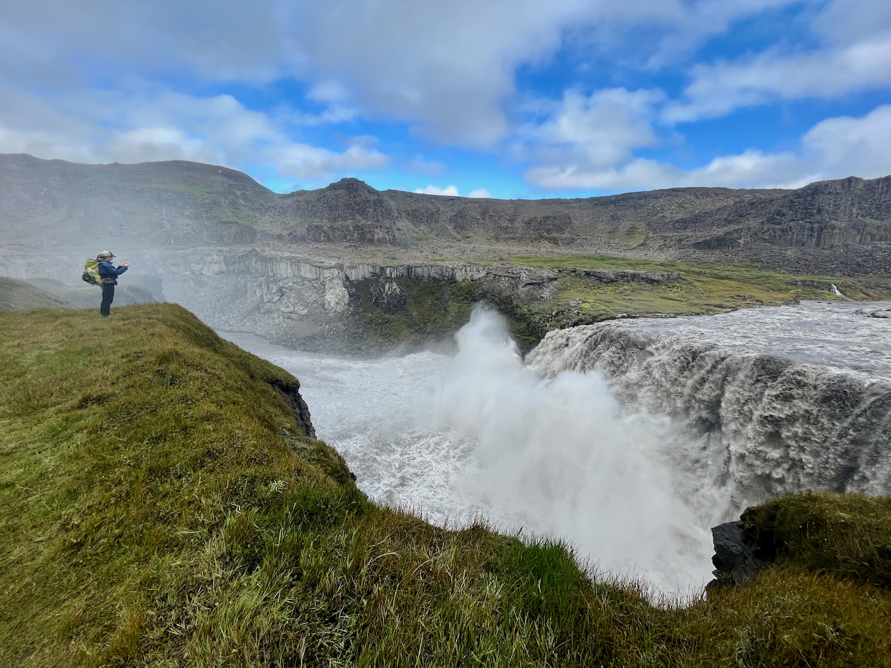
Hiker meets Hafragilsfoss
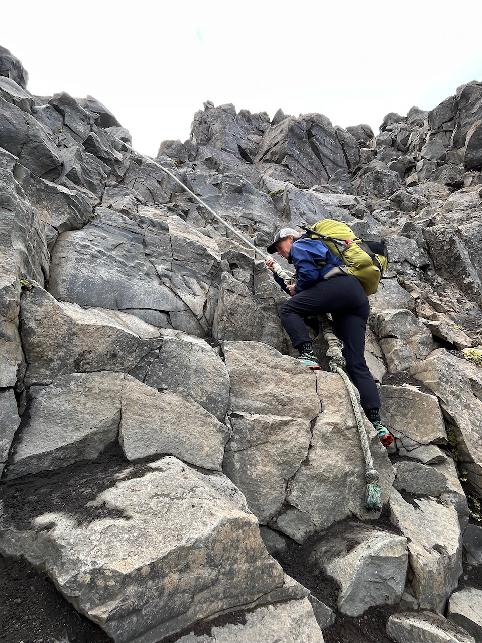
Ascending from the canyon floor.
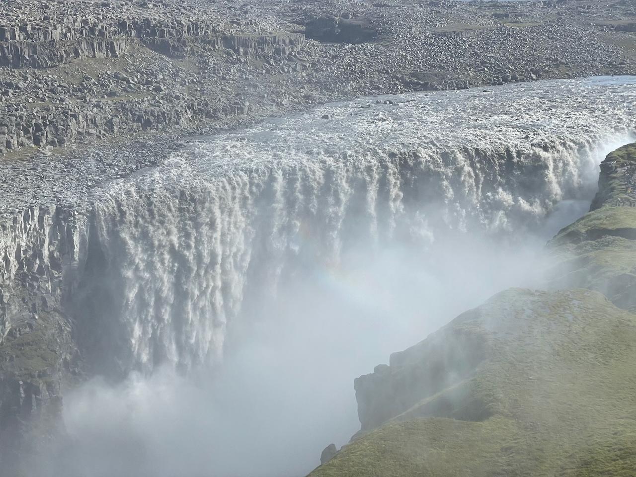
Dettifoss is Europe’s most powerful waterfall. At 100 m (328 ft) wide and 44 m (144 ft) high, it has an average flow rate of 193 m³/s (up to 500 m³/s in late summer). Such is the force of its plummeting glacially-grey water that you actually feel the ground reverberate underneath your feet while approaching.
The Story of “Yeoman” Tom: In the summer of 2000, I spent the best part of a couple of months cycling and hiking around Iceland. One of the most colourful characters I met on my journey was an Englishman named Tom. Hailing from Yorkshire, Tom had travelled to Iceland after a year-long rehabilitation following a near-fatal parachuting accident. Despite persistent pain in his back and left leg, which left him with a pronounced limp, he was invariably upbeat, funny as hell, and seemingly willing to attempt just about any adventure. I first encountered Tom while cycling the Kjölur route across the Icelandic interior, and one of the hikes we subsequently did together was the trail from Dettifoss to Ásbyrgi. Despite his physical limitations following the accident, Tom was a strong hiker and cyclist, but with tongue firmly in cheek, he always attributed his ability to just two things: a strong pot of Yorkshire tea in the morning and a double (sometimes triple) serving of Yeoman mashed potatoes at night. Not being a fan of “foreign food,” Tom had brought enough of both to last him the entire duration of his trip to Iceland. To this day, I’ve never met anyone who was as fond of potatoes as “Yeoman Tom.”
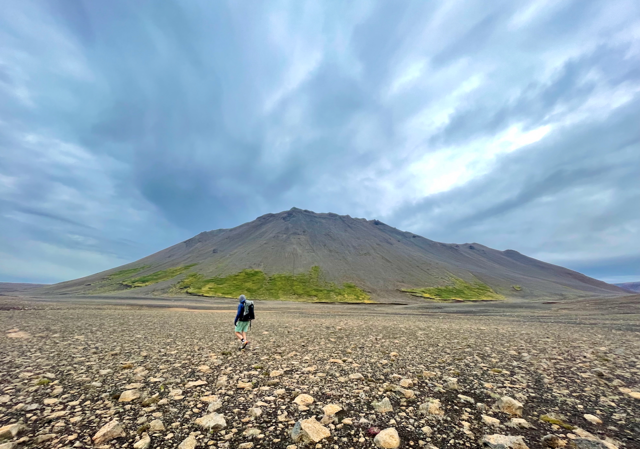
Easy cross-country walking past Jörundur and Krafla Volcanos (photo by Kate Pickett).
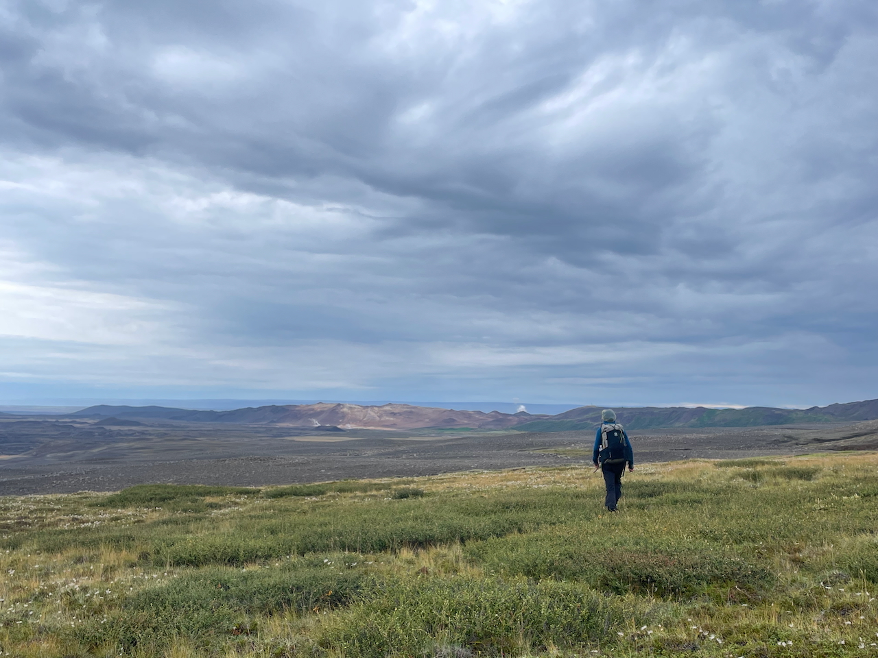
Making a beeline for the steaming geothermal area of Hverir (photo by Kate Pickett).
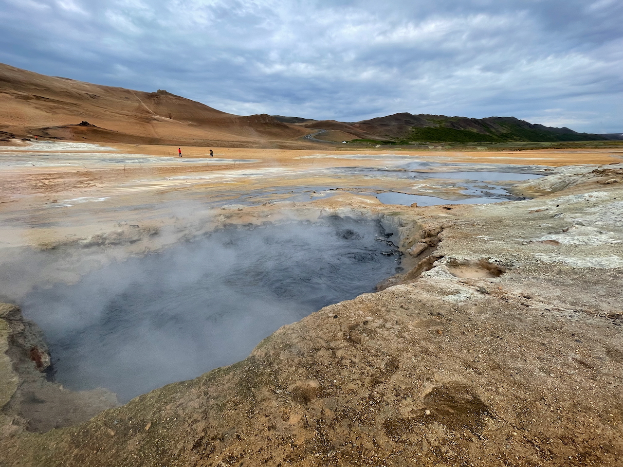
Hverir is an otherworldly geothermal area featuring bubbling grey mud pools, steaming fumaroles, and multi-hued mineral deposits.
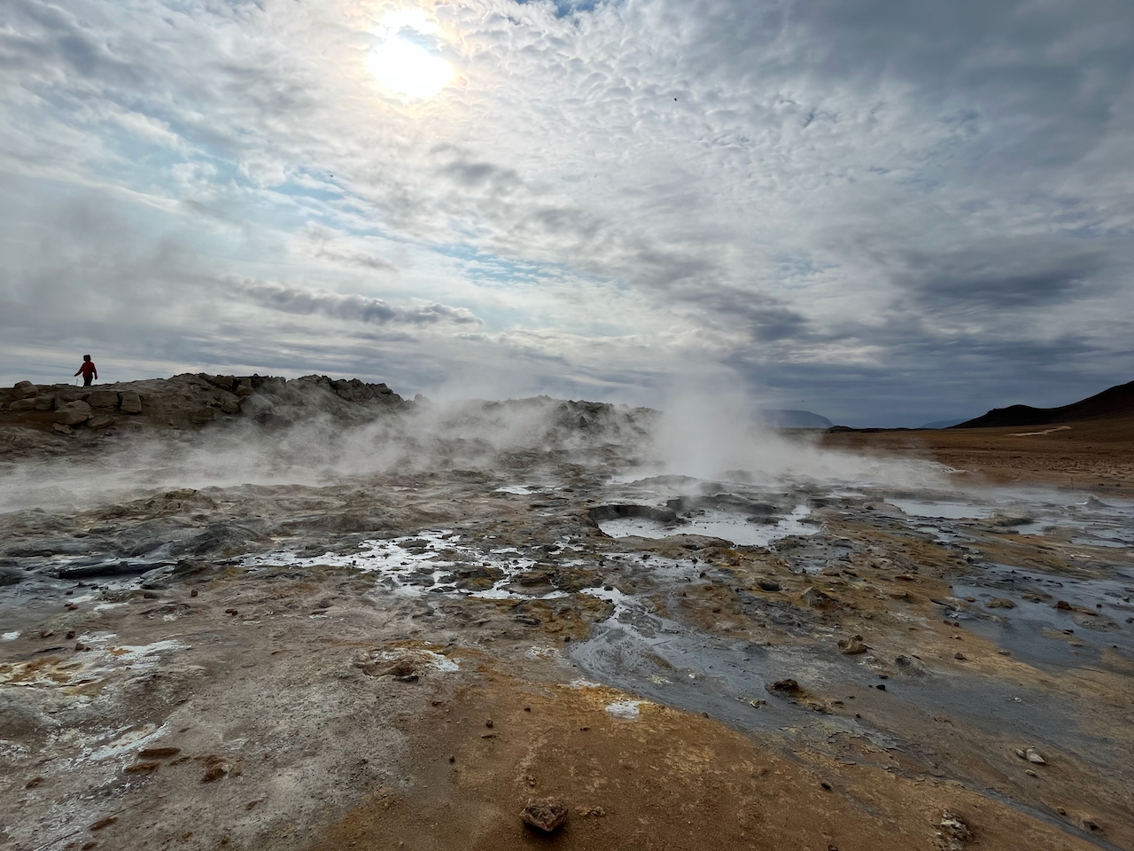
Steam rises, pools gurgle, and clouds drift.
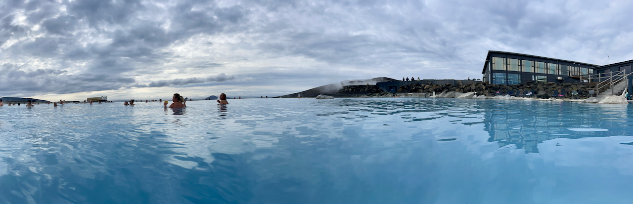
Myvatn Nature Baths – We arrived just after midday and stayed until 6pm (photo by Kate Pickett).
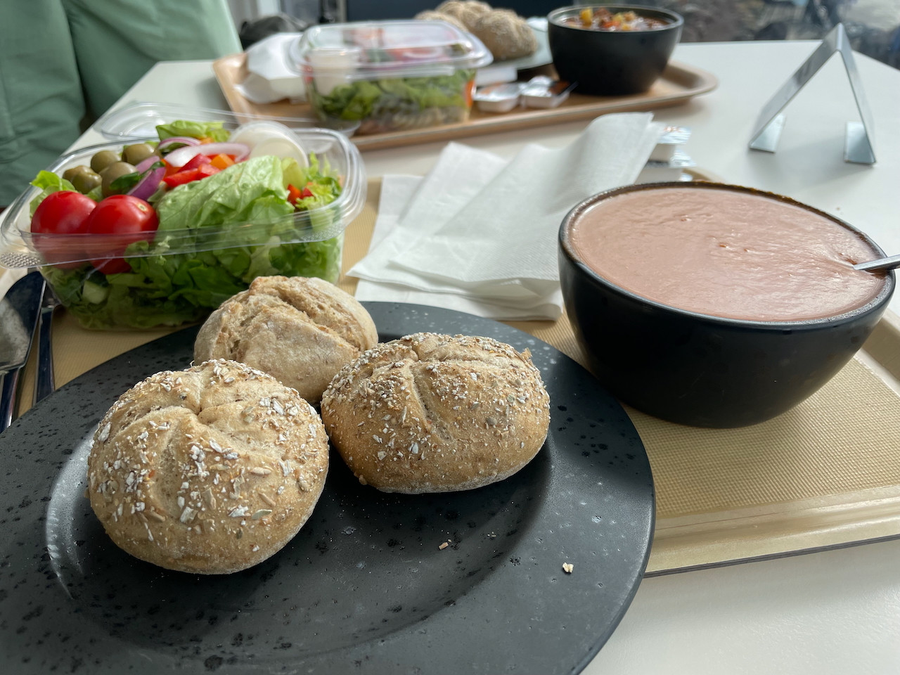
Lunch at the Nature Baths (photo by Kate Pickett).
Myvatn Nature Baths Vs Blue Lagoon – Which is Better?: I visited the latter on my first trip to Iceland back in 2000. Both places were great, but if I had to pick just one it would be Myvatn. Quieter, more laid back, walk in availability, less expensive, and the pools are just as nice. That said……….
Going Local: Pretty much every town in Iceland has a municipal pool with geothermally heated water, hot tubs, steam rooms, cold plunges, and swimming lanes, all for a fraction of the price. They’re a fundamental part of everyday Icelandic life. The upscale lagoons, on the other hand, primarily cater to tourists, offering more curated surroundings and premium amenities. Don’t get me wrong, they can be fun as a treat (we had an awesome time at the Myvatn Nature Baths!). But if you’re looking for an authentic Icelandic bathing experience, you can’t beat a local pool complex or one of the many natural hot springs dotted around the boonies of this singularly incredible country.
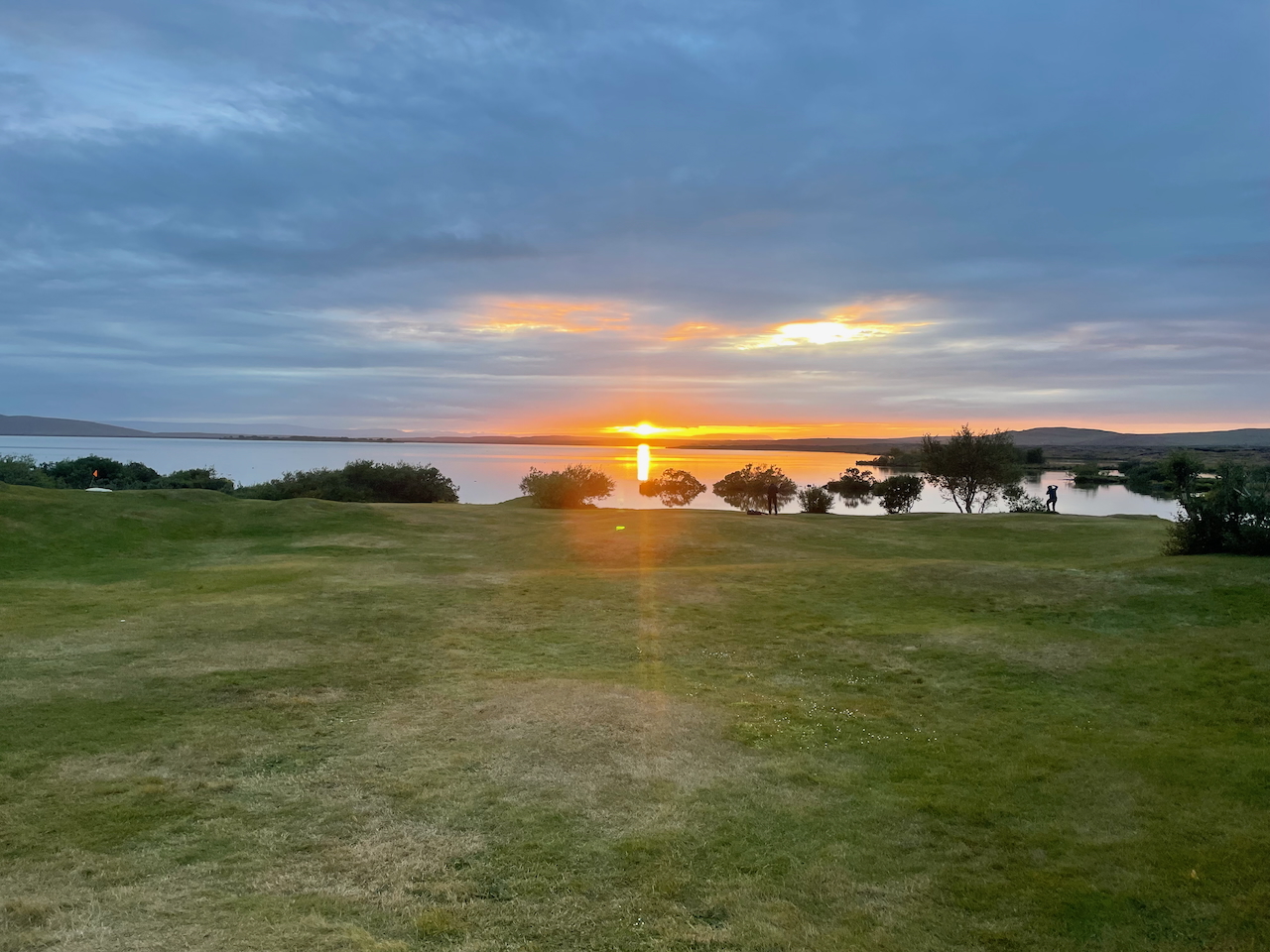
After the hot springs we made our way to the shores of Lake Myvatn.
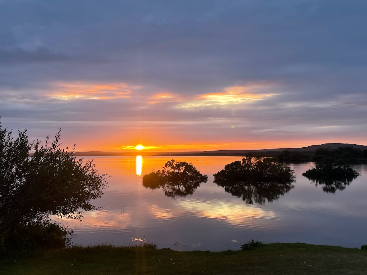
Sunset from our campsite on Lake Myvatn. The end of Stage 2 (photo by Kate Pickett).
Preview Stage 3:
The third stage of the Traverse takes hikers from the wetlands around Lake Mývatn into the heart of Iceland’s lunar-like interior. Heading along Mývatn’s eastern shore, the first 11 km (6.8 mi) follow Road 848 and offer the possibility of short side trips to the Hverfell crater and Dimmuborgir lava field. After two to three hours, you’ll reach a junction at the southern tip of the lake. At this point, tarmac is exchanged for dirt, and the highlands section of the Traverse begins…………..
(Note: The Iceland Traverse is one of the featured hikes in my book, Wanderlust Nordics: Exploring Trails in Scandinavia. For those interested, you can purchase a copy through Amazon, the Gestalten website, and other online retailers).
Related Posts
- Hiking Hornstrandir: Into Iceland’s Most Remote Wilderness
- Gear List: Iceland Traverse
- 100 Classic Hikes
Discover more from The Hiking Life
Subscribe to get the latest posts sent to your email.