Gear List: Cordillera Blanca Traverse (2022)

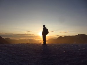
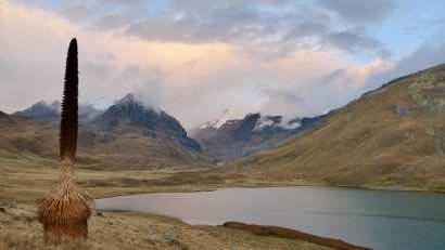
The Cordillera Blanca Traverse is a backcountry hiking route through one of South America’s highest and most beautiful mountain ranges. Measuring approximately 400 km (249 mi) in length, elevations during the hike ranged between 3,133 m (10,279 ft) and 5,201 Read More …

A Quick & Dirty Guide to the Sierra High Route

The Sierra High Route is one of the most spectacular and challenging treks in North America. Stretching approximately 195 miles (314 km) north to south through the Sierra Nevada, it is a largely off-trail affair that stays between 9,000 ft Read More …

When to Call it Quits on the Pacific Crest Trail

“With disturbing frequency, backpackers die in the mountains during the first snows of the season. Avalanche danger, hypothermia and obliterated trails are a threat to your life. Snow has closed the PCT in Washington as early as mid-September. In a Read More …

Winter is Coming

“The path wound its way through the snow laden trees. The forest had an ethereal quality, that made me feel as if I was floating rather than hiking. It was mid-November in the Appalachian mountains. Winter was coming.” ~ Cam Read More …

International Appalachian Trail | Canada & USA | 2011

Distance: 743 miles (1196 km) approx. Avg. Time:  45 – 50 days Start: Cap Gaspe, Quebec, Canada Finish: Mt.Katahdin, Baxter State Park, Maine, USA Maps / Information: In October 2011, I hiked from Cap Gaspe, Quebec, via New Brunswick to Read More …

A Peruvian Shepherd in Montana

The following meeting took place during my Continental Divide Trail hike of 2012: As I descended towards Morrison Lake, I was approached by a latino man on horseback. He greeted me with an enthusiastic, “Hola Amigo!” Much to his surprise, I responded in Spanish. Read More …

Cordillera Blanca Traverse – Stage 4 – Chavin to Pastoruri

Distance: 48 miles (77km) Time: 3 days (September 4 – 6) Start: Lake Queracocha Finish: Pastoruri Glacier   Day 14  Setting out from Lake Queracocha just before midday, I made my way cross country over the windswept, treeless landscape. Navigation Read More …

Cordillera Blanca Traverse – Stage 3 – Pitec to Chavin

At a Glance Distance: 46 miles (74 km) Time: 3 days Start:  Pitec Finish: Chavin   Stage 3 Notes Day 11 Upon arriving back at the Pitec trailhead, I met a park ranger by the name of Pedro. Pedro the Read More …

Quick & Dirty Guides to the Triple Crown

With the popularity of the Triple Crown increasing, the amount of information on the internet regarding the three long distance trails is staggering. Some of it is good; some of it not so much. That being the case, how does one separate Read More …

Cordillera Blanca Traverse – Stage 2 – Pompey to Pitec

Distance: 65 miles (105 km) Time: 5 days (including a rest day in Huaraz) Start: Pompey Returned to the CBT via a colectivo minibus from the town of Chacas. Finish: Pitec From Pitec, I got a 1 hr ride down Read More …

Cordillera Blanca Traverse – Stage 1 – Hualcallan to Pompey

Note:  Twenty minutes before beginning the Cordillera Blanca Traverse (CBT) in Hualcallan, I had the following conversation with an inquisitive local with a very dry sense of humor. It has been translated from Spanish to English. “Where are you headed?” Read More …

Cordillera Blanca Traverse (CBT) | Peru, 2014

Between August 21 and September 6, 2014, I completed a traverse of Peru’s Cordillera Blanca, one of the world’s highest and most beautiful mountain ranges. To the best of my knowledge, it was the first time that such a trek Read More …

Copper Canyon Traverse – Stage 4 – Batopilas to Cumbres de Sinforosa

At a Glance Date:  December 6-12 ( 6 days) Start:  Batopilas Finish:  Cumbres de Sinforosa Distance: 130.5 miles (210 km) Daily Average:  21.7 miles (35 km) Total Distance:  381 miles (613 km) The Highs and Lows of the CCT We reached Read More …

Copper Canyon Traverse – Stage 3 – Divisadero to Batopilas

At a Glance Date: December 2-5 (3.5 days) Start:  Divisadero Finish:  Batopilas Distance:  65.9 miles (106 km) Daily Average: 18.8 miles (30.3 km) Total Distance: 250.4 miles (403 km) Urique High Route Leaving Divisadero, our route skirted the western rim Read More …

Copper Canyon Traverse – Stage 2 – Creel to Divisadero

At a Glance Date:  November 27 – 30 (3.5 days) Start:  Creel Finish:  Divisadero Distance:  41.5 miles (67 km) Daily Average:  11. 8 miles (19.1 km) Total Distance:  184.5 miles (297 km) The Junkie Whilst hiking out of Creel at Read More …

Copper Canyon Traverse – Stage 1 – Basaseachic Falls to Creel

Date: November 19 – 26 (7.5 days) Start: Basaseachic Falls Finish:  Creel Distance: 143 miles (230 km) Daily Average: 19.1 miles (30.7 km) Total Distance: 143 miles (230 km) The Beginning Our trip began at Basaseachic Falls (246 m / 807 ft). Located in Read More …

ALDHA West Keynote Address – 12 Long Walks

Here is a video clip from the talk I gave at ALDHA West on September 28, 2013. This particular excerpt relates to the Southeastern Serpentine Trail, the sixth of the 12 Long Walks.  It includes reminisces about robberies, solitude, hypothermic weather and Pabst-Blue Ribbon Read More …

Continental Divide Trail Gear List (2012)

The CDT represented the penultimate hike of the 12 Long Walks series. I began my journey at Waterton Lake on the US/Canadian border on August 3. I reached Mexico 74 days later on October 15. In regard to conditions, I Read More …